You are here: Home > Network List > TA - USArray Transportable Network (new EarthScope stations) Stations List
> Station G21K Allakaket, AK, USA > Earthquake Result Viewer
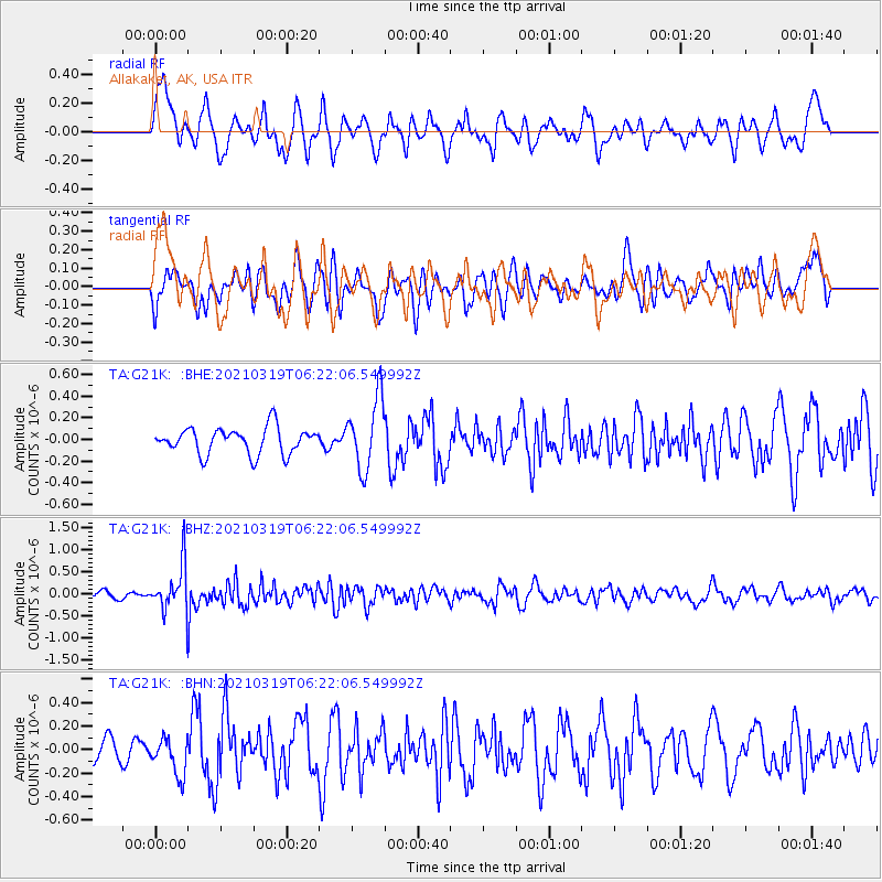
G21K Allakaket, AK, USA - Earthquake Result Viewer
*The percent match for this event was below the threshold and hence no stack was calculated.
| Earthquake location: |
Xizang |
| Earthquake latitude/longitude: |
31.9/92.9 |
| Earthquake time(UTC): |
2021/03/19 (078) 06:11:27 GMT |
| Earthquake Depth: |
10 km |
| Earthquake Magnitude: |
5.7 Mww |
| Earthquake Catalog/Contributor: |
NEIC PDE/us |
|
| Network: |
TA USArray Transportable Network (new EarthScope stations) |
| Station: |
G21K Allakaket, AK, USA |
| Lat/Lon: |
66.52 N/153.51 W |
| Elevation: |
446 m |
|
| Distance: |
69.8 deg |
| Az: |
23.038 deg |
| Baz: |
303.847 deg |
| Ray Param: |
$rayparam |
*The percent match for this event was below the threshold and hence was not used in the summary stack. |
|
| Radial Match: |
60.100555 % |
| Radial Bump: |
400 |
| Transverse Match: |
52.422215 % |
| Transverse Bump: |
400 |
| SOD ConfigId: |
24334971 |
| Insert Time: |
2021-04-02 06:27:01.599 +0000 |
| GWidth: |
2.5 |
| Max Bumps: |
400 |
| Tol: |
0.001 |
|
Signal To Noise
| Channel | StoN | STA | LTA |
| TA:G21K: :BHZ:20210319T06:22:06.549992Z | 5.15323 | 5.479673E-7 | 1.06334724E-7 |
| TA:G21K: :BHN:20210319T06:22:06.549992Z | 1.3436846 | 1.5822071E-7 | 1.17751384E-7 |
| TA:G21K: :BHE:20210319T06:22:06.549992Z | 2.7019448 | 3.281488E-7 | 1.214491E-7 |
| Arrivals |
| Ps | |
| PpPs | |
| PsPs/PpSs | |


