You are here: Home > Network List > TA - USArray Transportable Network (new EarthScope stations) Stations List
> Station I30M Mount Dempster, Yukon, CAN > Earthquake Result Viewer
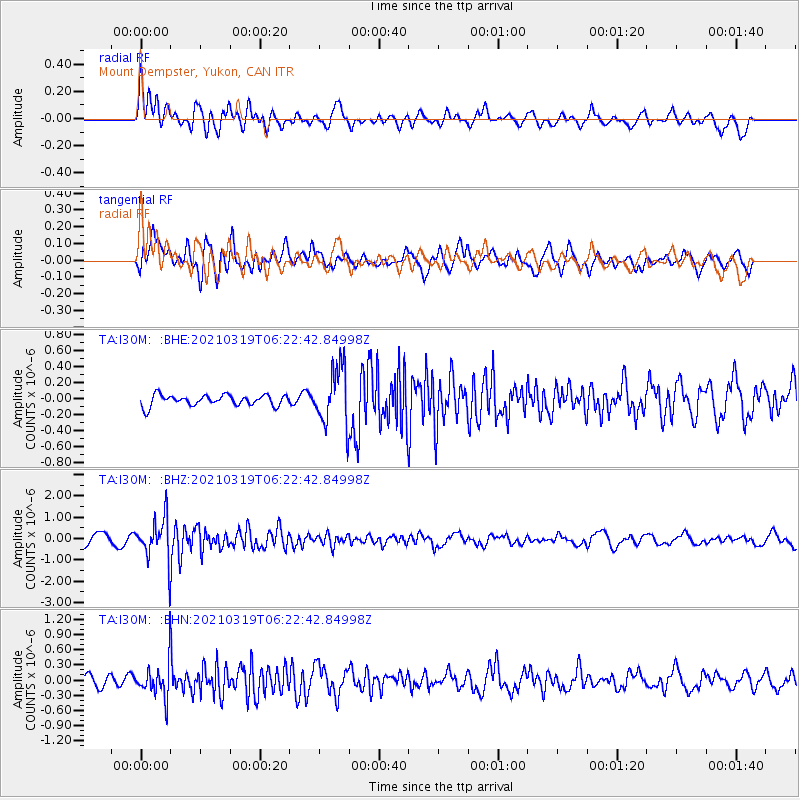
I30M Mount Dempster, Yukon, CAN - Earthquake Result Viewer
*The percent match for this event was below the threshold and hence no stack was calculated.
| Earthquake location: |
Xizang |
| Earthquake latitude/longitude: |
31.9/92.9 |
| Earthquake time(UTC): |
2021/03/19 (078) 06:11:27 GMT |
| Earthquake Depth: |
10 km |
| Earthquake Magnitude: |
5.7 Mww |
| Earthquake Catalog/Contributor: |
NEIC PDE/us |
|
| Network: |
TA USArray Transportable Network (new EarthScope stations) |
| Station: |
I30M Mount Dempster, Yukon, CAN |
| Lat/Lon: |
65.22 N/136.38 W |
| Elevation: |
1399 m |
|
| Distance: |
75.9 deg |
| Az: |
19.224 deg |
| Baz: |
318.356 deg |
| Ray Param: |
$rayparam |
*The percent match for this event was below the threshold and hence was not used in the summary stack. |
|
| Radial Match: |
60.61448 % |
| Radial Bump: |
400 |
| Transverse Match: |
71.2343 % |
| Transverse Bump: |
400 |
| SOD ConfigId: |
24334971 |
| Insert Time: |
2021-04-02 06:27:21.101 +0000 |
| GWidth: |
2.5 |
| Max Bumps: |
400 |
| Tol: |
0.001 |
|
Signal To Noise
| Channel | StoN | STA | LTA |
| TA:I30M: :BHZ:20210319T06:22:42.84998Z | 4.2613707 | 9.824636E-7 | 2.3055108E-7 |
| TA:I30M: :BHN:20210319T06:22:42.84998Z | 3.1235733 | 3.3664472E-7 | 1.0777551E-7 |
| TA:I30M: :BHE:20210319T06:22:42.84998Z | 5.2835293 | 3.6082042E-7 | 6.829155E-8 |
| Arrivals |
| Ps | |
| PpPs | |
| PsPs/PpSs | |


