You are here: Home > Network List > TA - USArray Transportable Network (new EarthScope stations) Stations List
> Station O17K Koliganek, Bristol Bay, AK, USA > Earthquake Result Viewer
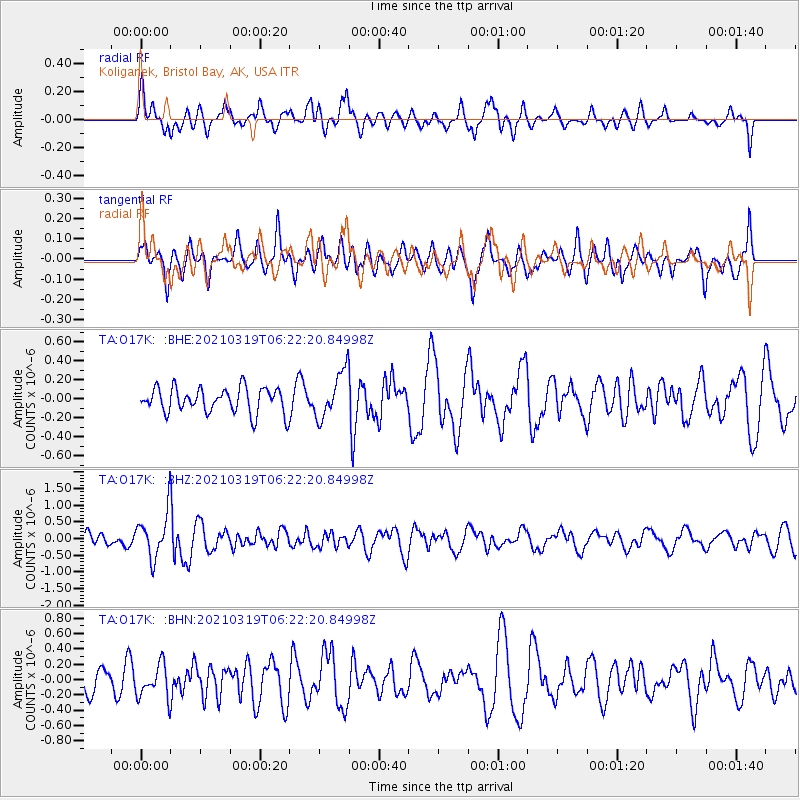
O17K Koliganek, Bristol Bay, AK, USA - Earthquake Result Viewer
*The percent match for this event was below the threshold and hence no stack was calculated.
| Earthquake location: |
Xizang |
| Earthquake latitude/longitude: |
31.9/92.9 |
| Earthquake time(UTC): |
2021/03/19 (078) 06:11:27 GMT |
| Earthquake Depth: |
10 km |
| Earthquake Magnitude: |
5.7 Mww |
| Earthquake Catalog/Contributor: |
NEIC PDE/us |
|
| Network: |
TA USArray Transportable Network (new EarthScope stations) |
| Station: |
O17K Koliganek, Bristol Bay, AK, USA |
| Lat/Lon: |
59.77 N/157.09 W |
| Elevation: |
156 m |
|
| Distance: |
72.2 deg |
| Az: |
29.964 deg |
| Baz: |
302.905 deg |
| Ray Param: |
$rayparam |
*The percent match for this event was below the threshold and hence was not used in the summary stack. |
|
| Radial Match: |
65.95764 % |
| Radial Bump: |
400 |
| Transverse Match: |
56.60499 % |
| Transverse Bump: |
400 |
| SOD ConfigId: |
24334971 |
| Insert Time: |
2021-04-02 06:27:48.660 +0000 |
| GWidth: |
2.5 |
| Max Bumps: |
400 |
| Tol: |
0.001 |
|
Signal To Noise
| Channel | StoN | STA | LTA |
| TA:O17K: :BHZ:20210319T06:22:20.84998Z | 3.6656477 | 6.7311856E-7 | 1.8362883E-7 |
| TA:O17K: :BHN:20210319T06:22:20.84998Z | 1.2246429 | 2.1666936E-7 | 1.7692453E-7 |
| TA:O17K: :BHE:20210319T06:22:20.84998Z | 1.8761806 | 2.4619007E-7 | 1.3121874E-7 |
| Arrivals |
| Ps | |
| PpPs | |
| PsPs/PpSs | |


