You are here: Home > Network List > GS - US Geological Survey Networks Stations List
> Station KAN10 Keim Farm > Earthquake Result Viewer
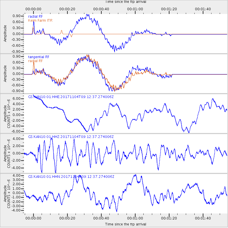
KAN10 Keim Farm - Earthquake Result Viewer
*The percent match for this event was below the threshold and hence no stack was calculated.
| Earthquake location: |
Tonga Islands |
| Earthquake latitude/longitude: |
-15.4/-173.2 |
| Earthquake time(UTC): |
2017/11/04 (308) 09:00:19 GMT |
| Earthquake Depth: |
10 km |
| Earthquake Magnitude: |
6.8 Mww |
| Earthquake Catalog/Contributor: |
NEIC PDE/us |
|
| Network: |
GS US Geological Survey Networks |
| Station: |
KAN10 Keim Farm |
| Lat/Lon: |
37.12 N/98.10 W |
| Elevation: |
417 m |
|
| Distance: |
87.7 deg |
| Az: |
50.634 deg |
| Baz: |
248.932 deg |
| Ray Param: |
$rayparam |
*The percent match for this event was below the threshold and hence was not used in the summary stack. |
|
| Radial Match: |
55.017673 % |
| Radial Bump: |
400 |
| Transverse Match: |
80.19794 % |
| Transverse Bump: |
400 |
| SOD ConfigId: |
2429771 |
| Insert Time: |
2017-11-18 09:03:00.163 +0000 |
| GWidth: |
2.5 |
| Max Bumps: |
400 |
| Tol: |
0.001 |
|
Signal To Noise
| Channel | StoN | STA | LTA |
| GS:KAN10:01:HHZ:20171104T09:12:37.274006Z | 8.859771 | 1.6915177E-6 | 1.9092117E-7 |
| GS:KAN10:01:HHN:20171104T09:12:37.274006Z | 0.6471406 | 1.039876E-6 | 1.606878E-6 |
| GS:KAN10:01:HHE:20171104T09:12:37.274006Z | 2.5007477 | 7.1612117E-6 | 2.8636282E-6 |
| Arrivals |
| Ps | |
| PpPs | |
| PsPs/PpSs | |


