You are here: Home > Network List > TA - USArray Transportable Network (new EarthScope stations) Stations List
> Station R33M Jennings River, BC, CAN > Earthquake Result Viewer
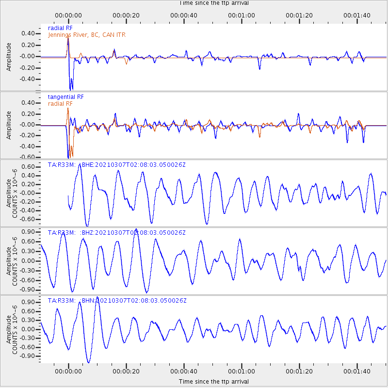
R33M Jennings River, BC, CAN - Earthquake Result Viewer
*The percent match for this event was below the threshold and hence no stack was calculated.
| Earthquake location: |
Kermadec Islands Region |
| Earthquake latitude/longitude: |
-28.5/-176.6 |
| Earthquake time(UTC): |
2021/03/07 (066) 01:55:10 GMT |
| Earthquake Depth: |
8.0 km |
| Earthquake Magnitude: |
5.5 Mww |
| Earthquake Catalog/Contributor: |
NEIC PDE/us |
|
| Network: |
TA USArray Transportable Network (new EarthScope stations) |
| Station: |
R33M Jennings River, BC, CAN |
| Lat/Lon: |
59.39 N/130.97 W |
| Elevation: |
1437 m |
|
| Distance: |
95.3 deg |
| Az: |
21.55 deg |
| Baz: |
219.203 deg |
| Ray Param: |
$rayparam |
*The percent match for this event was below the threshold and hence was not used in the summary stack. |
|
| Radial Match: |
85.127106 % |
| Radial Bump: |
400 |
| Transverse Match: |
57.43794 % |
| Transverse Bump: |
400 |
| SOD ConfigId: |
24334971 |
| Insert Time: |
2021-04-02 22:41:20.011 +0000 |
| GWidth: |
2.5 |
| Max Bumps: |
400 |
| Tol: |
0.001 |
|
Signal To Noise
| Channel | StoN | STA | LTA |
| TA:R33M: :BHZ:20210307T02:08:03.050026Z | 1.2175639 | 5.844031E-7 | 4.7997736E-7 |
| TA:R33M: :BHN:20210307T02:08:03.050026Z | 2.1468508 | 5.663189E-7 | 2.6379053E-7 |
| TA:R33M: :BHE:20210307T02:08:03.050026Z | 0.76445574 | 2.673059E-7 | 3.4966826E-7 |
| Arrivals |
| Ps | |
| PpPs | |
| PsPs/PpSs | |


