You are here: Home > Network List > CI - Caltech Regional Seismic Network Stations List
> Station MPM Manuel Prospect Mine, California, USA > Earthquake Result Viewer
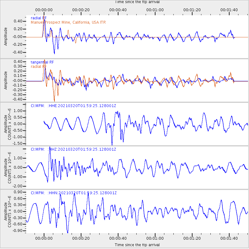
MPM Manuel Prospect Mine, California, USA - Earthquake Result Viewer
*The percent match for this event was below the threshold and hence no stack was calculated.
| Earthquake location: |
Northern Mid-Atlantic Ridge |
| Earthquake latitude/longitude: |
47.3/-27.3 |
| Earthquake time(UTC): |
2021/03/20 (079) 01:49:18 GMT |
| Earthquake Depth: |
10 km |
| Earthquake Magnitude: |
5.8 Mww |
| Earthquake Catalog/Contributor: |
NEIC PDE/us |
|
| Network: |
CI Caltech Regional Seismic Network |
| Station: |
MPM Manuel Prospect Mine, California, USA |
| Lat/Lon: |
36.06 N/117.49 W |
| Elevation: |
185 m |
|
| Distance: |
64.7 deg |
| Az: |
296.322 deg |
| Baz: |
48.857 deg |
| Ray Param: |
$rayparam |
*The percent match for this event was below the threshold and hence was not used in the summary stack. |
|
| Radial Match: |
43.291046 % |
| Radial Bump: |
400 |
| Transverse Match: |
58.158966 % |
| Transverse Bump: |
400 |
| SOD ConfigId: |
24334971 |
| Insert Time: |
2021-04-03 01:59:04.051 +0000 |
| GWidth: |
2.5 |
| Max Bumps: |
400 |
| Tol: |
0.001 |
|
Signal To Noise
| Channel | StoN | STA | LTA |
| CI:MPM: :HHZ:20210320T01:59:25.128001Z | 4.1218615 | 9.982473E-7 | 2.421836E-7 |
| CI:MPM: :HHN:20210320T01:59:25.128001Z | 1.2041184 | 3.072185E-7 | 2.5513978E-7 |
| CI:MPM: :HHE:20210320T01:59:25.128001Z | 1.4991754 | 5.028545E-7 | 3.3542074E-7 |
| Arrivals |
| Ps | |
| PpPs | |
| PsPs/PpSs | |


