You are here: Home > Network List > TA - USArray Transportable Network (new EarthScope stations) Stations List
> Station E20K Nigu River, AK, USA > Earthquake Result Viewer
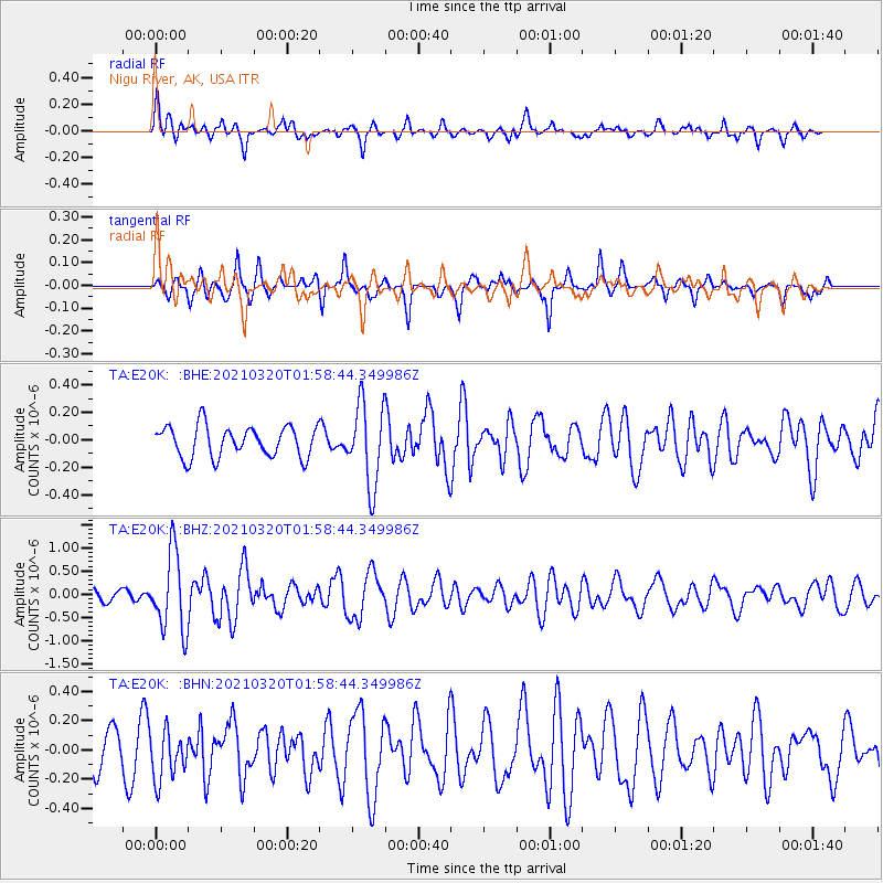
E20K Nigu River, AK, USA - Earthquake Result Viewer
*The percent match for this event was below the threshold and hence no stack was calculated.
| Earthquake location: |
Northern Mid-Atlantic Ridge |
| Earthquake latitude/longitude: |
47.3/-27.3 |
| Earthquake time(UTC): |
2021/03/20 (079) 01:49:18 GMT |
| Earthquake Depth: |
10 km |
| Earthquake Magnitude: |
5.8 Mww |
| Earthquake Catalog/Contributor: |
NEIC PDE/us |
|
| Network: |
TA USArray Transportable Network (new EarthScope stations) |
| Station: |
E20K Nigu River, AK, USA |
| Lat/Lon: |
68.26 N/156.19 W |
| Elevation: |
866 m |
|
| Distance: |
58.6 deg |
| Az: |
340.143 deg |
| Baz: |
38.364 deg |
| Ray Param: |
$rayparam |
*The percent match for this event was below the threshold and hence was not used in the summary stack. |
|
| Radial Match: |
72.16744 % |
| Radial Bump: |
400 |
| Transverse Match: |
63.336227 % |
| Transverse Bump: |
313 |
| SOD ConfigId: |
24334971 |
| Insert Time: |
2021-04-03 02:11:28.858 +0000 |
| GWidth: |
2.5 |
| Max Bumps: |
400 |
| Tol: |
0.001 |
|
Signal To Noise
| Channel | StoN | STA | LTA |
| TA:E20K: :BHZ:20210320T01:58:44.349986Z | 8.183822 | 8.468085E-7 | 1.03473475E-7 |
| TA:E20K: :BHN:20210320T01:58:44.349986Z | 1.3736665 | 1.682678E-7 | 1.224954E-7 |
| TA:E20K: :BHE:20210320T01:58:44.349986Z | 2.6402256 | 2.9715468E-7 | 1.12548975E-7 |
| Arrivals |
| Ps | |
| PpPs | |
| PsPs/PpSs | |


