You are here: Home > Network List > TA - USArray Transportable Network (new EarthScope stations) Stations List
> Station I17K Unalakleet, AK, USA > Earthquake Result Viewer
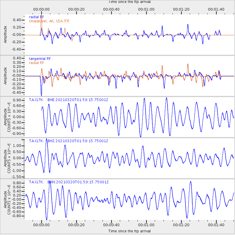
I17K Unalakleet, AK, USA - Earthquake Result Viewer
*The percent match for this event was below the threshold and hence no stack was calculated.
| Earthquake location: |
Northern Mid-Atlantic Ridge |
| Earthquake latitude/longitude: |
47.3/-27.3 |
| Earthquake time(UTC): |
2021/03/20 (079) 01:49:18 GMT |
| Earthquake Depth: |
10 km |
| Earthquake Magnitude: |
5.8 Mww |
| Earthquake Catalog/Contributor: |
NEIC PDE/us |
|
| Network: |
TA USArray Transportable Network (new EarthScope stations) |
| Station: |
I17K Unalakleet, AK, USA |
| Lat/Lon: |
63.89 N/160.70 W |
| Elevation: |
105 m |
|
| Distance: |
63.3 deg |
| Az: |
338.894 deg |
| Baz: |
33.639 deg |
| Ray Param: |
$rayparam |
*The percent match for this event was below the threshold and hence was not used in the summary stack. |
|
| Radial Match: |
50.649258 % |
| Radial Bump: |
262 |
| Transverse Match: |
38.68141 % |
| Transverse Bump: |
257 |
| SOD ConfigId: |
24334971 |
| Insert Time: |
2021-04-03 02:12:03.252 +0000 |
| GWidth: |
2.5 |
| Max Bumps: |
400 |
| Tol: |
0.001 |
|
Signal To Noise
| Channel | StoN | STA | LTA |
| TA:I17K: :BHZ:20210320T01:59:15.75001Z | 2.2743852 | 8.584103E-7 | 3.7742518E-7 |
| TA:I17K: :BHN:20210320T01:59:15.75001Z | 1.3675965 | 5.08112E-7 | 3.7153652E-7 |
| TA:I17K: :BHE:20210320T01:59:15.75001Z | 0.71568125 | 2.9864208E-7 | 4.1728362E-7 |
| Arrivals |
| Ps | |
| PpPs | |
| PsPs/PpSs | |


