You are here: Home > Network List > TA - USArray Transportable Network (new EarthScope stations) Stations List
> Station R33M Jennings River, BC, CAN > Earthquake Result Viewer
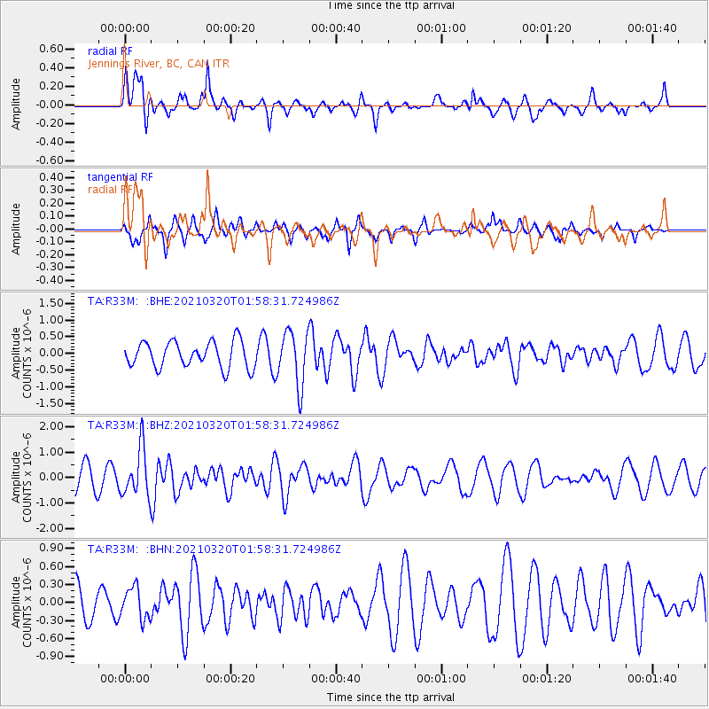
R33M Jennings River, BC, CAN - Earthquake Result Viewer
*The percent match for this event was below the threshold and hence no stack was calculated.
| Earthquake location: |
Northern Mid-Atlantic Ridge |
| Earthquake latitude/longitude: |
47.3/-27.3 |
| Earthquake time(UTC): |
2021/03/20 (079) 01:49:18 GMT |
| Earthquake Depth: |
10 km |
| Earthquake Magnitude: |
5.8 Mww |
| Earthquake Catalog/Contributor: |
NEIC PDE/us |
|
| Network: |
TA USArray Transportable Network (new EarthScope stations) |
| Station: |
R33M Jennings River, BC, CAN |
| Lat/Lon: |
59.39 N/130.97 W |
| Elevation: |
1437 m |
|
| Distance: |
56.8 deg |
| Az: |
323.563 deg |
| Baz: |
52.212 deg |
| Ray Param: |
$rayparam |
*The percent match for this event was below the threshold and hence was not used in the summary stack. |
|
| Radial Match: |
74.753204 % |
| Radial Bump: |
400 |
| Transverse Match: |
59.06003 % |
| Transverse Bump: |
331 |
| SOD ConfigId: |
24334971 |
| Insert Time: |
2021-04-03 02:12:41.136 +0000 |
| GWidth: |
2.5 |
| Max Bumps: |
400 |
| Tol: |
0.001 |
|
Signal To Noise
| Channel | StoN | STA | LTA |
| TA:R33M: :BHZ:20210320T01:58:31.724986Z | 2.3008277 | 9.494158E-7 | 4.1264096E-7 |
| TA:R33M: :BHN:20210320T01:58:31.724986Z | 0.9161668 | 2.645054E-7 | 2.8870878E-7 |
| TA:R33M: :BHE:20210320T01:58:31.724986Z | 2.107834 | 8.22098E-7 | 3.9002023E-7 |
| Arrivals |
| Ps | |
| PpPs | |
| PsPs/PpSs | |


