You are here: Home > Network List > US - United States National Seismic Network Stations List
> Station OGNE Ogallala, Nebraska, USA > Earthquake Result Viewer
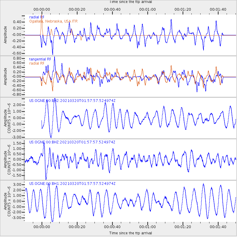
OGNE Ogallala, Nebraska, USA - Earthquake Result Viewer
*The percent match for this event was below the threshold and hence no stack was calculated.
| Earthquake location: |
Northern Mid-Atlantic Ridge |
| Earthquake latitude/longitude: |
47.3/-27.3 |
| Earthquake time(UTC): |
2021/03/20 (079) 01:49:18 GMT |
| Earthquake Depth: |
10 km |
| Earthquake Magnitude: |
5.8 Mww |
| Earthquake Catalog/Contributor: |
NEIC PDE/us |
|
| Network: |
US United States National Seismic Network |
| Station: |
OGNE Ogallala, Nebraska, USA |
| Lat/Lon: |
40.95 N/102.03 W |
| Elevation: |
1054 m |
|
| Distance: |
52.1 deg |
| Az: |
292.204 deg |
| Baz: |
56.313 deg |
| Ray Param: |
$rayparam |
*The percent match for this event was below the threshold and hence was not used in the summary stack. |
|
| Radial Match: |
44.442932 % |
| Radial Bump: |
338 |
| Transverse Match: |
35.653423 % |
| Transverse Bump: |
304 |
| SOD ConfigId: |
24334971 |
| Insert Time: |
2021-04-03 02:15:24.198 +0000 |
| GWidth: |
2.5 |
| Max Bumps: |
400 |
| Tol: |
0.001 |
|
Signal To Noise
| Channel | StoN | STA | LTA |
| US:OGNE:00:BHZ:20210320T01:57:57.524974Z | 4.2825055 | 9.734399E-7 | 2.2730617E-7 |
| US:OGNE:00:BH1:20210320T01:57:57.524974Z | 1.7978069 | 2.0969685E-6 | 1.1664036E-6 |
| US:OGNE:00:BH2:20210320T01:57:57.524974Z | 0.68612725 | 8.982619E-7 | 1.3091768E-6 |
| Arrivals |
| Ps | |
| PpPs | |
| PsPs/PpSs | |


