You are here: Home > Network List > NE - New England Seismic Network Stations List
> Station EMMW Machias, ME, USA > Earthquake Result Viewer
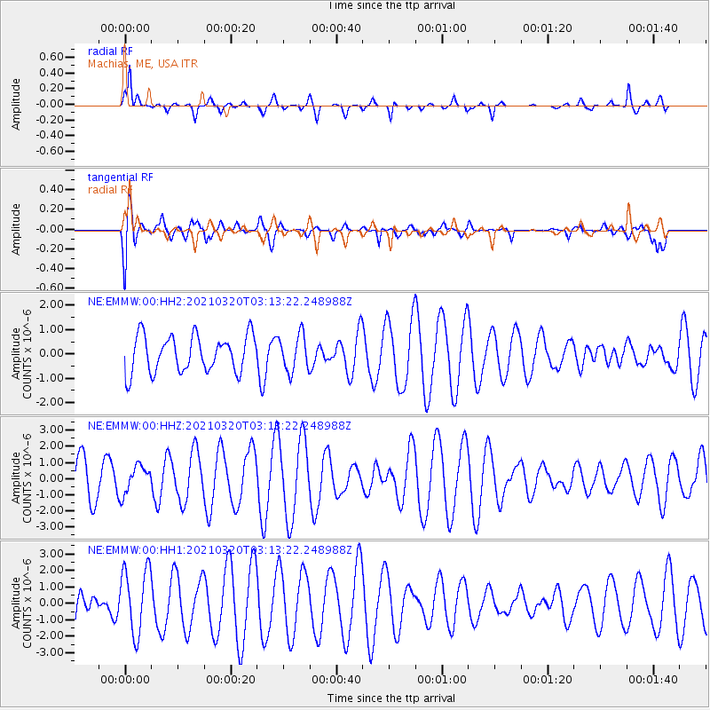
EMMW Machias, ME, USA - Earthquake Result Viewer
*The percent match for this event was below the threshold and hence no stack was calculated.
| Earthquake location: |
Near Coast Of Guerrero, Mexico |
| Earthquake latitude/longitude: |
16.7/-98.8 |
| Earthquake time(UTC): |
2021/03/20 (079) 03:06:33 GMT |
| Earthquake Depth: |
28 km |
| Earthquake Magnitude: |
5.7 Mww |
| Earthquake Catalog/Contributor: |
NEIC PDE/us |
|
| Network: |
NE New England Seismic Network |
| Station: |
EMMW Machias, ME, USA |
| Lat/Lon: |
44.71 N/67.46 W |
| Elevation: |
35 m |
|
| Distance: |
38.4 deg |
| Az: |
36.654 deg |
| Baz: |
233.371 deg |
| Ray Param: |
$rayparam |
*The percent match for this event was below the threshold and hence was not used in the summary stack. |
|
| Radial Match: |
66.17029 % |
| Radial Bump: |
326 |
| Transverse Match: |
52.746216 % |
| Transverse Bump: |
400 |
| SOD ConfigId: |
24334971 |
| Insert Time: |
2021-04-03 03:16:27.023 +0000 |
| GWidth: |
2.5 |
| Max Bumps: |
400 |
| Tol: |
0.001 |
|
Signal To Noise
| Channel | StoN | STA | LTA |
| NE:EMMW:00:HHZ:20210320T03:13:22.248988Z | 0.50699383 | 8.6235724E-7 | 1.7009226E-6 |
| NE:EMMW:00:HH1:20210320T03:13:22.248988Z | 2.1681507 | 2.0058003E-6 | 9.251204E-7 |
| NE:EMMW:00:HH2:20210320T03:13:22.248988Z | 0.99624944 | 7.4621386E-7 | 7.490231E-7 |
| Arrivals |
| Ps | |
| PpPs | |
| PsPs/PpSs | |


