You are here: Home > Network List > UW - Pacific Northwest Regional Seismic Network Stations List
> Station FISH Seaside, OR, USA > Earthquake Result Viewer
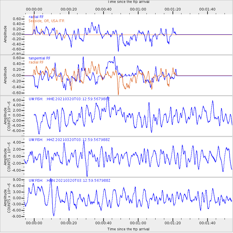
FISH Seaside, OR, USA - Earthquake Result Viewer
*The percent match for this event was below the threshold and hence no stack was calculated.
| Earthquake location: |
Near Coast Of Guerrero, Mexico |
| Earthquake latitude/longitude: |
16.7/-98.8 |
| Earthquake time(UTC): |
2021/03/20 (079) 03:06:33 GMT |
| Earthquake Depth: |
28 km |
| Earthquake Magnitude: |
5.7 Mww |
| Earthquake Catalog/Contributor: |
NEIC PDE/us |
|
| Network: |
UW Pacific Northwest Regional Seismic Network |
| Station: |
FISH Seaside, OR, USA |
| Lat/Lon: |
45.93 N/123.56 W |
| Elevation: |
325 m |
|
| Distance: |
35.8 deg |
| Az: |
329.997 deg |
| Baz: |
136.623 deg |
| Ray Param: |
$rayparam |
*The percent match for this event was below the threshold and hence was not used in the summary stack. |
|
| Radial Match: |
47.973972 % |
| Radial Bump: |
400 |
| Transverse Match: |
34.56027 % |
| Transverse Bump: |
400 |
| SOD ConfigId: |
24334971 |
| Insert Time: |
2021-04-03 03:18:59.106 +0000 |
| GWidth: |
2.5 |
| Max Bumps: |
400 |
| Tol: |
0.001 |
|
Signal To Noise
| Channel | StoN | STA | LTA |
| UW:FISH: :HHZ:20210320T03:12:59.567988Z | 0.81957847 | 1.2686056E-6 | 1.5478757E-6 |
| UW:FISH: :HHN:20210320T03:12:59.567988Z | 3.7154849 | 6.1949077E-6 | 1.6673214E-6 |
| UW:FISH: :HHE:20210320T03:12:59.567988Z | 1.1665046 | 2.8321606E-6 | 2.4279036E-6 |
| Arrivals |
| Ps | |
| PpPs | |
| PsPs/PpSs | |


