You are here: Home > Network List > US - United States National Seismic Network Stations List
> Station DGMT Dagmar, Montana, USA > Earthquake Result Viewer
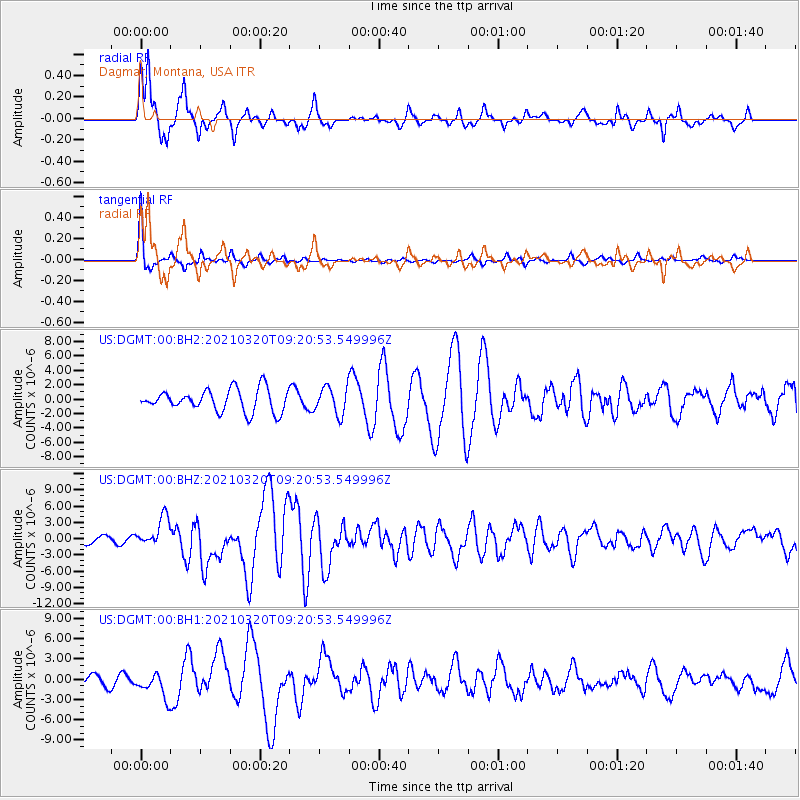
DGMT Dagmar, Montana, USA - Earthquake Result Viewer
*The percent match for this event was below the threshold and hence no stack was calculated.
| Earthquake location: |
Near East Coast Of Honshu, Japan |
| Earthquake latitude/longitude: |
38.5/141.6 |
| Earthquake time(UTC): |
2021/03/20 (079) 09:09:45 GMT |
| Earthquake Depth: |
54 km |
| Earthquake Magnitude: |
7.0 Mww |
| Earthquake Catalog/Contributor: |
NEIC PDE/us |
|
| Network: |
US United States National Seismic Network |
| Station: |
DGMT Dagmar, Montana, USA |
| Lat/Lon: |
48.47 N/104.20 W |
| Elevation: |
0.0 m |
|
| Distance: |
75.6 deg |
| Az: |
38.804 deg |
| Baz: |
312.345 deg |
| Ray Param: |
$rayparam |
*The percent match for this event was below the threshold and hence was not used in the summary stack. |
|
| Radial Match: |
85.644226 % |
| Radial Bump: |
334 |
| Transverse Match: |
89.34979 % |
| Transverse Bump: |
196 |
| SOD ConfigId: |
24334971 |
| Insert Time: |
2021-04-03 09:44:51.544 +0000 |
| GWidth: |
2.5 |
| Max Bumps: |
400 |
| Tol: |
0.001 |
|
Signal To Noise
| Channel | StoN | STA | LTA |
| US:DGMT:00:BHZ:20210320T09:20:53.549996Z | 3.652126 | 2.7075328E-6 | 7.4135795E-7 |
| US:DGMT:00:BH1:20210320T09:20:53.549996Z | 2.469471 | 1.798195E-6 | 7.2817005E-7 |
| US:DGMT:00:BH2:20210320T09:20:53.549996Z | 1.2315729 | 1.908278E-6 | 1.5494641E-6 |
| Arrivals |
| Ps | |
| PpPs | |
| PsPs/PpSs | |


