You are here: Home > Network List > CI - Caltech Regional Seismic Network Stations List
> Station GMR Granite Mountains Research Center > Earthquake Result Viewer
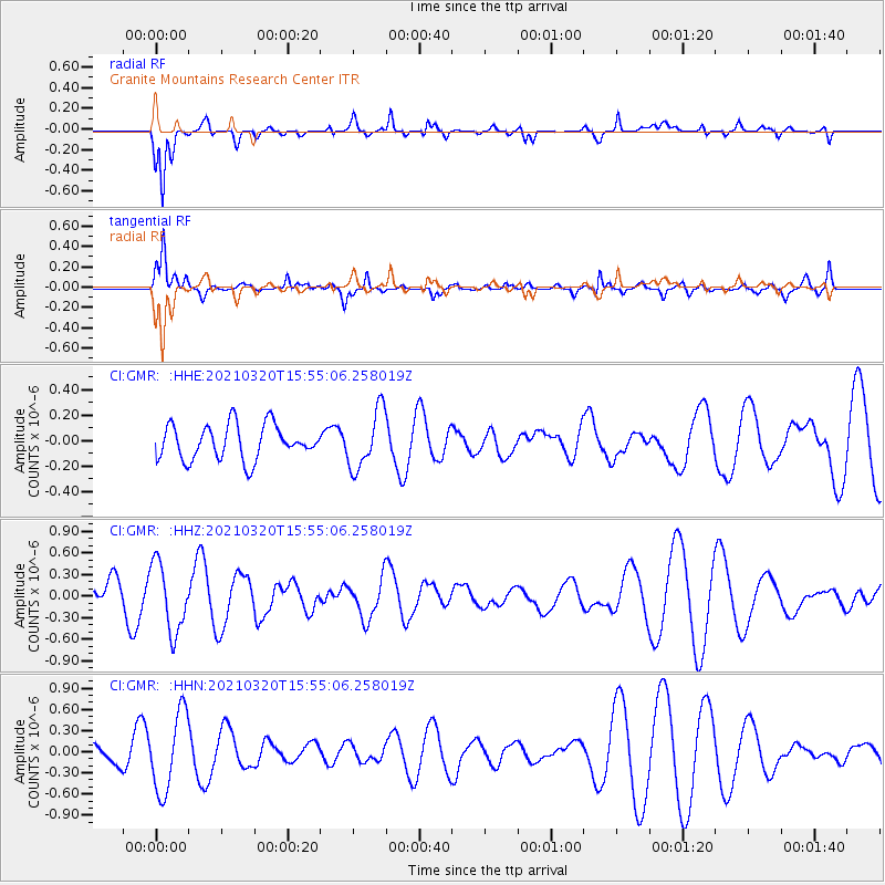
GMR Granite Mountains Research Center - Earthquake Result Viewer
*The percent match for this event was below the threshold and hence no stack was calculated.
| Earthquake location: |
Southeast Of Loyalty Islands |
| Earthquake latitude/longitude: |
-23.2/171.7 |
| Earthquake time(UTC): |
2021/03/20 (079) 15:42:39 GMT |
| Earthquake Depth: |
10 km |
| Earthquake Magnitude: |
5.5 Mww |
| Earthquake Catalog/Contributor: |
NEIC PDE/us |
|
| Network: |
CI Caltech Regional Seismic Network |
| Station: |
GMR Granite Mountains Research Center |
| Lat/Lon: |
34.78 N/115.66 W |
| Elevation: |
1326 m |
|
| Distance: |
89.8 deg |
| Az: |
51.795 deg |
| Baz: |
241.482 deg |
| Ray Param: |
$rayparam |
*The percent match for this event was below the threshold and hence was not used in the summary stack. |
|
| Radial Match: |
75.9922 % |
| Radial Bump: |
400 |
| Transverse Match: |
72.554886 % |
| Transverse Bump: |
386 |
| SOD ConfigId: |
24334971 |
| Insert Time: |
2021-04-03 15:48:35.386 +0000 |
| GWidth: |
2.5 |
| Max Bumps: |
400 |
| Tol: |
0.001 |
|
Signal To Noise
| Channel | StoN | STA | LTA |
| CI:GMR: :HHZ:20210320T15:55:06.258019Z | 2.822415 | 4.7546558E-7 | 1.6846053E-7 |
| CI:GMR: :HHN:20210320T15:55:06.258019Z | 3.8983927 | 5.578549E-7 | 1.430987E-7 |
| CI:GMR: :HHE:20210320T15:55:06.258019Z | 1.6953579 | 2.3063238E-7 | 1.3603758E-7 |
| Arrivals |
| Ps | |
| PpPs | |
| PsPs/PpSs | |


