You are here: Home > Network List > AG - Arkansas Seismic Network Stations List
> Station U40A Yellville, AR > Earthquake Result Viewer
U40A Yellville, AR - Earthquake Result Viewer

| Earthquake location: |
Leeward Islands |
| Earthquake latitude/longitude: |
16.7/-60.8 |
| Earthquake time(UTC): |
2021/03/26 (085) 04:51:39 GMT |
| Earthquake Depth: |
26 km |
| Earthquake Magnitude: |
5.8 mww |
| Earthquake Catalog/Contributor: |
NEIC PDE/us |
|
| Network: |
AG Arkansas Seismic Network |
| Station: |
U40A Yellville, AR |
| Lat/Lon: |
36.36 N/92.85 W |
| Elevation: |
374 m |
|
| Distance: |
34.5 deg |
| Az: |
310.865 deg |
| Baz: |
116.116 deg |
| Ray Param: |
0.07768263 |
| Estimated Moho Depth: |
39.0 km |
| Estimated Crust Vp/Vs: |
1.88 |
| Assumed Crust Vp: |
6.53 km/s |
| Estimated Crust Vs: |
3.483 km/s |
| Estimated Crust Poisson's Ratio: |
0.30 |
|
| Radial Match: |
88.59173 % |
| Radial Bump: |
358 |
| Transverse Match: |
71.990685 % |
| Transverse Bump: |
400 |
| SOD ConfigId: |
24334971 |
| Insert Time: |
2021-04-09 04:53:46.205 +0000 |
| GWidth: |
2.5 |
| Max Bumps: |
400 |
| Tol: |
0.001 |
|
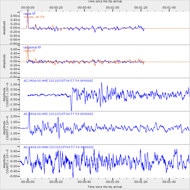
Signal To Noise
| Channel | StoN | STA | LTA |
| AG:U40A:00:HHZ:20210326T04:57:54.964999Z | 17.820944 | 1.0260628E-6 | 5.7576234E-8 |
| AG:U40A:00:HHN:20210326T04:57:54.964999Z | 3.5323484 | 2.3901939E-7 | 6.766585E-8 |
| AG:U40A:00:HHE:20210326T04:57:54.964999Z | 12.64439 | 6.110675E-7 | 4.8327163E-8 |
| Arrivals |
| Ps | 5.6 SECOND |
| PpPs | 16 SECOND |
| PsPs/PpSs | 22 SECOND |


