You are here: Home > Network List > IW - Intermountain West Stations List
> Station MOOW Moose Ponds, Wyoming, USA > Earthquake Result Viewer
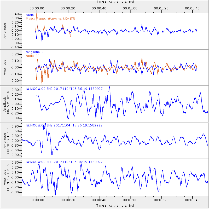
MOOW Moose Ponds, Wyoming, USA - Earthquake Result Viewer
*The percent match for this event was below the threshold and hence no stack was calculated.
| Earthquake location: |
Tonga Islands |
| Earthquake latitude/longitude: |
-15.2/-173.3 |
| Earthquake time(UTC): |
2017/11/04 (308) 15:24:31 GMT |
| Earthquake Depth: |
10 km |
| Earthquake Magnitude: |
5.6 mb |
| Earthquake Catalog/Contributor: |
NEIC PDE/us |
|
| Network: |
IW Intermountain West |
| Station: |
MOOW Moose Ponds, Wyoming, USA |
| Lat/Lon: |
43.75 N/110.74 W |
| Elevation: |
2128 m |
|
| Distance: |
81.8 deg |
| Az: |
40.541 deg |
| Baz: |
239.998 deg |
| Ray Param: |
$rayparam |
*The percent match for this event was below the threshold and hence was not used in the summary stack. |
|
| Radial Match: |
65.640594 % |
| Radial Bump: |
400 |
| Transverse Match: |
57.623367 % |
| Transverse Bump: |
400 |
| SOD ConfigId: |
2429771 |
| Insert Time: |
2017-11-18 15:27:22.571 +0000 |
| GWidth: |
2.5 |
| Max Bumps: |
400 |
| Tol: |
0.001 |
|
Signal To Noise
| Channel | StoN | STA | LTA |
| IW:MOOW:00:BHZ:20171104T15:36:19.158992Z | 3.4288619 | 4.4365294E-7 | 1.2938781E-7 |
| IW:MOOW:00:BH1:20171104T15:36:19.158992Z | 1.8251541 | 1.6847048E-7 | 9.23048E-8 |
| IW:MOOW:00:BH2:20171104T15:36:19.158992Z | 1.4671174 | 1.7617357E-7 | 1.2008144E-7 |
| Arrivals |
| Ps | |
| PpPs | |
| PsPs/PpSs | |


