You are here: Home > Network List > CI - Caltech Regional Seismic Network Stations List
> Station SWS Sam W. Stewart, Westmorland, CA, USA > Earthquake Result Viewer
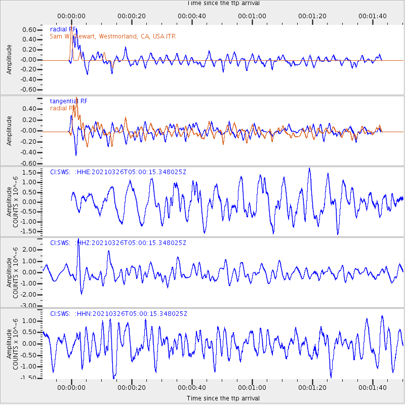
SWS Sam W. Stewart, Westmorland, CA, USA - Earthquake Result Viewer
*The percent match for this event was below the threshold and hence no stack was calculated.
| Earthquake location: |
Leeward Islands |
| Earthquake latitude/longitude: |
16.7/-60.8 |
| Earthquake time(UTC): |
2021/03/26 (085) 04:51:39 GMT |
| Earthquake Depth: |
26 km |
| Earthquake Magnitude: |
5.8 mww |
| Earthquake Catalog/Contributor: |
NEIC PDE/us |
|
| Network: |
CI Caltech Regional Seismic Network |
| Station: |
SWS Sam W. Stewart, Westmorland, CA, USA |
| Lat/Lon: |
32.94 N/115.80 W |
| Elevation: |
140 m |
|
| Distance: |
51.9 deg |
| Az: |
298.957 deg |
| Baz: |
94.21 deg |
| Ray Param: |
$rayparam |
*The percent match for this event was below the threshold and hence was not used in the summary stack. |
|
| Radial Match: |
79.03405 % |
| Radial Bump: |
400 |
| Transverse Match: |
66.47095 % |
| Transverse Bump: |
400 |
| SOD ConfigId: |
24334971 |
| Insert Time: |
2021-04-09 05:04:33.847 +0000 |
| GWidth: |
2.5 |
| Max Bumps: |
400 |
| Tol: |
0.001 |
|
Signal To Noise
| Channel | StoN | STA | LTA |
| CI:SWS: :HHZ:20210326T05:00:15.348025Z | 3.1359448 | 1.1405193E-6 | 3.636924E-7 |
| CI:SWS: :HHN:20210326T05:00:15.348025Z | 1.3125944 | 4.7982485E-7 | 3.6555457E-7 |
| CI:SWS: :HHE:20210326T05:00:15.348025Z | 1.1379895 | 6.455498E-7 | 5.6727214E-7 |
| Arrivals |
| Ps | |
| PpPs | |
| PsPs/PpSs | |


