KASH XW.KASH - Earthquake Result Viewer
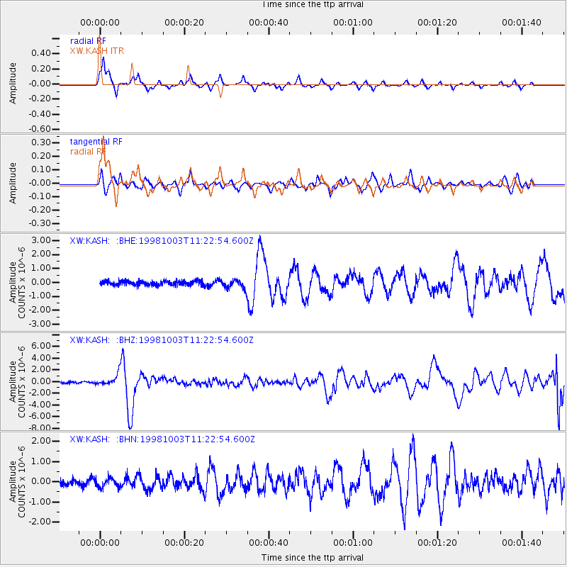
Earthquake location: Northwest Of Ryukyu Islands
Earthquake latitude/longitude: 28.5/127.6
Earthquake time(UTC): 1998/10/03 (276) 11:15:42 GMT
Earthquake Depth: 227 km
Earthquake Magnitude: 5.6 MB, 6.1 UNKNOWN, 6.1 MW
Earthquake Catalog/Contributor: WHDF/NEIC
Network: XW Tien Shan Continental Dynamics
Station: KASH XW.KASH
Lat/Lon: 39.52 N/75.92 E
Elevation: 1310 m
Distance: 43.7 deg
Az: 298.541 deg
Baz: 88.219 deg
Ray Param: 0.0714889
Estimated Moho Depth: 24.5 km
Estimated Crust Vp/Vs: 1.60
Assumed Crust Vp: 6.472 km/s
Estimated Crust Vs: 4.045 km/s
Estimated Crust Poisson's Ratio: 0.18
Radial Match: 81.206924 %
Radial Bump: 362
Transverse Match: 64.84467 %
Transverse Bump: 400
SOD ConfigId: 4480
Insert Time: 2010-02-26 15:27:47.742 +0000
GWidth: 2.5
Max Bumps: 400
Tol: 0.001

Signal To Noise

ChannelStoNSTALTA
XW:KASH: :BHZ:19981003T11:22:54.600Z8.4126551.0347417E-61.2299823E-7
XW:KASH: :BHN:19981003T11:22:54.600Z1.4123652.2344517E-71.5820639E-7
XW:KASH: :BHE:19981003T11:22:54.600Z2.08839923.3430427E-71.600768E-7
Arrivals
Ps2.4 SECOND
PpPs9.2 SECOND
PsPs/PpSs12 SECOND