You are here: Home > Network List > TA - USArray Transportable Network (new EarthScope stations) Stations List
> Station A36M Sachs Harbour, NT, CAN > Earthquake Result Viewer
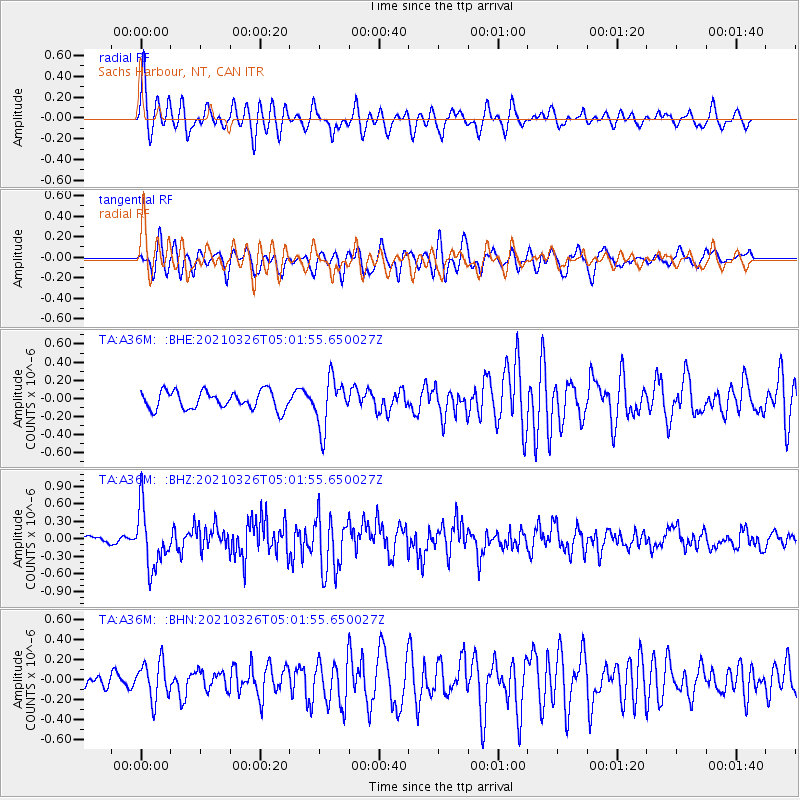
A36M Sachs Harbour, NT, CAN - Earthquake Result Viewer
*The percent match for this event was below the threshold and hence no stack was calculated.
| Earthquake location: |
Leeward Islands |
| Earthquake latitude/longitude: |
16.7/-60.8 |
| Earthquake time(UTC): |
2021/03/26 (085) 04:51:39 GMT |
| Earthquake Depth: |
26 km |
| Earthquake Magnitude: |
5.8 mww |
| Earthquake Catalog/Contributor: |
NEIC PDE/us |
|
| Network: |
TA USArray Transportable Network (new EarthScope stations) |
| Station: |
A36M Sachs Harbour, NT, CAN |
| Lat/Lon: |
71.99 N/125.25 W |
| Elevation: |
32 m |
|
| Distance: |
66.4 deg |
| Az: |
342.171 deg |
| Baz: |
109.395 deg |
| Ray Param: |
$rayparam |
*The percent match for this event was below the threshold and hence was not used in the summary stack. |
|
| Radial Match: |
74.1941 % |
| Radial Bump: |
400 |
| Transverse Match: |
74.15643 % |
| Transverse Bump: |
400 |
| SOD ConfigId: |
24334971 |
| Insert Time: |
2021-04-09 05:17:53.414 +0000 |
| GWidth: |
2.5 |
| Max Bumps: |
400 |
| Tol: |
0.001 |
|
Signal To Noise
| Channel | StoN | STA | LTA |
| TA:A36M: :BHZ:20210326T05:01:55.650027Z | 7.9757085 | 5.0449904E-7 | 6.325445E-8 |
| TA:A36M: :BHN:20210326T05:01:55.650027Z | 1.893439 | 1.9076228E-7 | 1.00749105E-7 |
| TA:A36M: :BHE:20210326T05:01:55.650027Z | 2.742577 | 2.6953268E-7 | 9.8277155E-8 |
| Arrivals |
| Ps | |
| PpPs | |
| PsPs/PpSs | |


