You are here: Home > Network List > TA - USArray Transportable Network (new EarthScope stations) Stations List
> Station F26K Sheenjek River, AK, USA > Earthquake Result Viewer
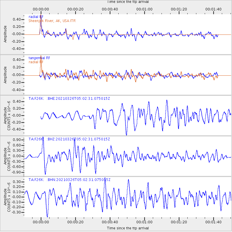
F26K Sheenjek River, AK, USA - Earthquake Result Viewer
*The percent match for this event was below the threshold and hence no stack was calculated.
| Earthquake location: |
Leeward Islands |
| Earthquake latitude/longitude: |
16.7/-60.8 |
| Earthquake time(UTC): |
2021/03/26 (085) 04:51:39 GMT |
| Earthquake Depth: |
26 km |
| Earthquake Magnitude: |
5.8 mww |
| Earthquake Catalog/Contributor: |
NEIC PDE/us |
|
| Network: |
TA USArray Transportable Network (new EarthScope stations) |
| Station: |
F26K Sheenjek River, AK, USA |
| Lat/Lon: |
67.69 N/144.15 W |
| Elevation: |
683 m |
|
| Distance: |
72.2 deg |
| Az: |
336.53 deg |
| Baz: |
89.639 deg |
| Ray Param: |
$rayparam |
*The percent match for this event was below the threshold and hence was not used in the summary stack. |
|
| Radial Match: |
78.33272 % |
| Radial Bump: |
400 |
| Transverse Match: |
59.06522 % |
| Transverse Bump: |
400 |
| SOD ConfigId: |
24334971 |
| Insert Time: |
2021-04-09 05:18:19.304 +0000 |
| GWidth: |
2.5 |
| Max Bumps: |
400 |
| Tol: |
0.001 |
|
Signal To Noise
| Channel | StoN | STA | LTA |
| TA:F26K: :BHZ:20210326T05:02:31.075015Z | 6.466333 | 5.336557E-7 | 8.252834E-8 |
| TA:F26K: :BHN:20210326T05:02:31.075015Z | 1.8674926 | 1.5752651E-7 | 8.435189E-8 |
| TA:F26K: :BHE:20210326T05:02:31.075015Z | 2.4604762 | 1.650614E-7 | 6.708514E-8 |
| Arrivals |
| Ps | |
| PpPs | |
| PsPs/PpSs | |


