You are here: Home > Network List > US - United States National Seismic Network Stations List
> Station EGMT Eagleton, Montana, USA > Earthquake Result Viewer
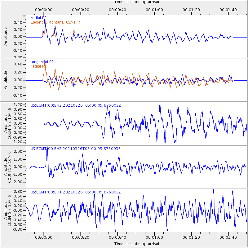
EGMT Eagleton, Montana, USA - Earthquake Result Viewer
*The percent match for this event was below the threshold and hence no stack was calculated.
| Earthquake location: |
Leeward Islands |
| Earthquake latitude/longitude: |
16.7/-60.8 |
| Earthquake time(UTC): |
2021/03/26 (085) 04:51:39 GMT |
| Earthquake Depth: |
26 km |
| Earthquake Magnitude: |
5.8 mww |
| Earthquake Catalog/Contributor: |
NEIC PDE/us |
|
| Network: |
US United States National Seismic Network |
| Station: |
EGMT Eagleton, Montana, USA |
| Lat/Lon: |
48.02 N/109.75 W |
| Elevation: |
1055 m |
|
| Distance: |
50.6 deg |
| Az: |
319.112 deg |
| Baz: |
110.842 deg |
| Ray Param: |
$rayparam |
*The percent match for this event was below the threshold and hence was not used in the summary stack. |
|
| Radial Match: |
79.892685 % |
| Radial Bump: |
400 |
| Transverse Match: |
68.31608 % |
| Transverse Bump: |
400 |
| SOD ConfigId: |
24334971 |
| Insert Time: |
2021-04-09 05:22:23.466 +0000 |
| GWidth: |
2.5 |
| Max Bumps: |
400 |
| Tol: |
0.001 |
|
Signal To Noise
| Channel | StoN | STA | LTA |
| US:EGMT:00:BHZ:20210326T05:00:05.875003Z | 10.261744 | 1.0368876E-6 | 1.01043995E-7 |
| US:EGMT:00:BH1:20210326T05:00:05.875003Z | 1.2261559 | 2.3963142E-7 | 1.9543309E-7 |
| US:EGMT:00:BH2:20210326T05:00:05.875003Z | 4.0836806 | 5.45432E-7 | 1.3356383E-7 |
| Arrivals |
| Ps | |
| PpPs | |
| PsPs/PpSs | |


