You are here: Home > Network List > US - United States National Seismic Network Stations List
> Station LAO LASA Array, Montana, USA > Earthquake Result Viewer
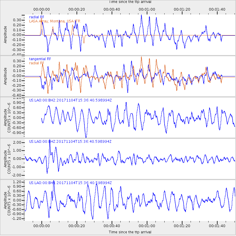
LAO LASA Array, Montana, USA - Earthquake Result Viewer
*The percent match for this event was below the threshold and hence no stack was calculated.
| Earthquake location: |
Tonga Islands |
| Earthquake latitude/longitude: |
-15.2/-173.3 |
| Earthquake time(UTC): |
2017/11/04 (308) 15:24:31 GMT |
| Earthquake Depth: |
10 km |
| Earthquake Magnitude: |
5.6 mb |
| Earthquake Catalog/Contributor: |
NEIC PDE/us |
|
| Network: |
US United States National Seismic Network |
| Station: |
LAO LASA Array, Montana, USA |
| Lat/Lon: |
46.69 N/106.22 W |
| Elevation: |
902 m |
|
| Distance: |
86.0 deg |
| Az: |
39.475 deg |
| Baz: |
243.086 deg |
| Ray Param: |
$rayparam |
*The percent match for this event was below the threshold and hence was not used in the summary stack. |
|
| Radial Match: |
72.16078 % |
| Radial Bump: |
400 |
| Transverse Match: |
60.2066 % |
| Transverse Bump: |
400 |
| SOD ConfigId: |
2429771 |
| Insert Time: |
2017-11-18 15:30:03.255 +0000 |
| GWidth: |
2.5 |
| Max Bumps: |
400 |
| Tol: |
0.001 |
|
Signal To Noise
| Channel | StoN | STA | LTA |
| US:LAO:00:BHZ:20171104T15:36:40.598994Z | 3.1296206 | 9.071222E-7 | 2.8985053E-7 |
| US:LAO:00:BH1:20171104T15:36:40.598994Z | 1.4939294 | 4.7783027E-7 | 3.1984794E-7 |
| US:LAO:00:BH2:20171104T15:36:40.598994Z | 0.6309281 | 2.3079988E-7 | 3.658101E-7 |
| Arrivals |
| Ps | |
| PpPs | |
| PsPs/PpSs | |


