You are here: Home > Network List > US - United States National Seismic Network Stations List
> Station HAWA Hanford, Washington, USA > Earthquake Result Viewer
HAWA Hanford, Washington, USA - Earthquake Result Viewer
*The percent match for this event was below the threshold and hence no stack was calculated.
| Earthquake location: |
Leeward Islands |
| Earthquake latitude/longitude: |
16.7/-60.8 |
| Earthquake time(UTC): |
2021/03/26 (085) 04:51:39 GMT |
| Earthquake Depth: |
26 km |
| Earthquake Magnitude: |
5.8 mww |
| Earthquake Catalog/Contributor: |
NEIC PDE/us |
|
| Network: |
US United States National Seismic Network |
| Station: |
HAWA Hanford, Washington, USA |
| Lat/Lon: |
46.39 N/119.53 W |
| Elevation: |
364 m |
|
| Distance: |
56.6 deg |
| Az: |
314.89 deg |
| Baz: |
101.172 deg |
| Ray Param: |
$rayparam |
*The percent match for this event was below the threshold and hence was not used in the summary stack. |
|
| Radial Match: |
77.693665 % |
| Radial Bump: |
400 |
| Transverse Match: |
65.28169 % |
| Transverse Bump: |
400 |
| SOD ConfigId: |
24334971 |
| Insert Time: |
2021-04-09 05:22:29.622 +0000 |
| GWidth: |
2.5 |
| Max Bumps: |
400 |
| Tol: |
0.001 |
|
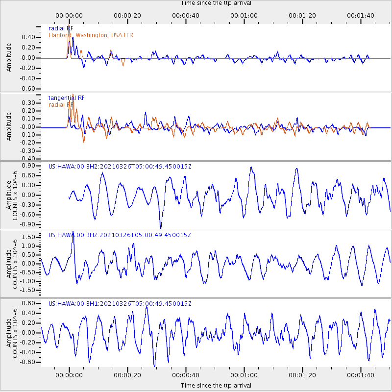
Signal To Noise
| Channel | StoN | STA | LTA |
| US:HAWA:00:BHZ:20210326T05:00:49.450015Z | 1.8086115 | 8.205734E-7 | 4.5370354E-7 |
| US:HAWA:00:BH1:20210326T05:00:49.450015Z | 0.86456984 | 2.1199551E-7 | 2.4520347E-7 |
| US:HAWA:00:BH2:20210326T05:00:49.450015Z | 1.5163385 | 4.911346E-7 | 3.2389508E-7 |
| Arrivals |
| Ps | |
| PpPs | |
| PsPs/PpSs | |


