You are here: Home > Network List > GM - US Geological Survey Networks Stations List
> Station IWM01 Jericho 2M Well Monitoring Station > Earthquake Result Viewer
IWM01 Jericho 2M Well Monitoring Station - Earthquake Result Viewer
*The percent match for this event was below the threshold and hence no stack was calculated.
| Earthquake location: |
Windward Islands |
| Earthquake latitude/longitude: |
11.7/-61.2 |
| Earthquake time(UTC): |
2017/11/05 (309) 15:00:24 GMT |
| Earthquake Depth: |
47 km |
| Earthquake Magnitude: |
5.5 Mww |
| Earthquake Catalog/Contributor: |
NEIC PDE/us |
|
| Network: |
GM US Geological Survey Networks |
| Station: |
IWM01 Jericho 2M Well Monitoring Station |
| Lat/Lon: |
36.73 N/96.53 W |
| Elevation: |
328 m |
|
| Distance: |
40.4 deg |
| Az: |
314.168 deg |
| Baz: |
119.003 deg |
| Ray Param: |
$rayparam |
*The percent match for this event was below the threshold and hence was not used in the summary stack. |
|
| Radial Match: |
44.59302 % |
| Radial Bump: |
400 |
| Transverse Match: |
81.04709 % |
| Transverse Bump: |
400 |
| SOD ConfigId: |
2429771 |
| Insert Time: |
2017-11-19 15:01:08.870 +0000 |
| GWidth: |
2.5 |
| Max Bumps: |
400 |
| Tol: |
0.001 |
|
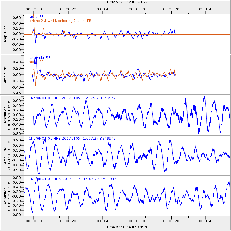
Signal To Noise
| Channel | StoN | STA | LTA |
| GM:IWM01:01:HHZ:20171105T15:07:27.384994Z | 3.2903557 | 7.153005E-7 | 2.1739304E-7 |
| GM:IWM01:01:HHN:20171105T15:07:27.384994Z | 2.2578123 | 5.448613E-7 | 2.4132268E-7 |
| GM:IWM01:01:HHE:20171105T15:07:27.384994Z | 1.4837434 | 3.876007E-7 | 2.612316E-7 |
| Arrivals |
| Ps | |
| PpPs | |
| PsPs/PpSs | |


