You are here: Home > Network List > TA - USArray Transportable Network (new EarthScope stations) Stations List
> Station D23K Nanushuk River, AK USA > Earthquake Result Viewer
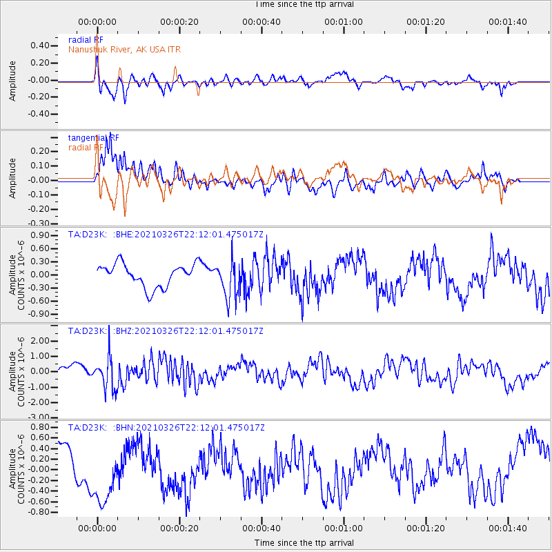
D23K Nanushuk River, AK USA - Earthquake Result Viewer
*The percent match for this event was below the threshold and hence no stack was calculated.
| Earthquake location: |
Northeast Of Taiwan |
| Earthquake latitude/longitude: |
26.1/125.1 |
| Earthquake time(UTC): |
2021/03/26 (085) 22:02:15 GMT |
| Earthquake Depth: |
147 km |
| Earthquake Magnitude: |
5.9 mww |
| Earthquake Catalog/Contributor: |
NEIC PDE/us |
|
| Network: |
TA USArray Transportable Network (new EarthScope stations) |
| Station: |
D23K Nanushuk River, AK USA |
| Lat/Lon: |
68.97 N/150.68 W |
| Elevation: |
406 m |
|
| Distance: |
63.8 deg |
| Az: |
23.593 deg |
| Baz: |
274.729 deg |
| Ray Param: |
$rayparam |
*The percent match for this event was below the threshold and hence was not used in the summary stack. |
|
| Radial Match: |
67.48625 % |
| Radial Bump: |
400 |
| Transverse Match: |
83.78901 % |
| Transverse Bump: |
400 |
| SOD ConfigId: |
24334971 |
| Insert Time: |
2021-04-09 22:18:09.903 +0000 |
| GWidth: |
2.5 |
| Max Bumps: |
400 |
| Tol: |
0.001 |
|
Signal To Noise
| Channel | StoN | STA | LTA |
| TA:D23K: :BHZ:20210326T22:12:01.475017Z | 2.6743085 | 1.0267848E-6 | 3.8394404E-7 |
| TA:D23K: :BHN:20210326T22:12:01.475017Z | 1.2750791 | 5.512168E-7 | 4.3230006E-7 |
| TA:D23K: :BHE:20210326T22:12:01.475017Z | 1.6671135 | 4.3624348E-7 | 2.6167592E-7 |
| Arrivals |
| Ps | |
| PpPs | |
| PsPs/PpSs | |


