You are here: Home > Network List > TA - USArray Transportable Network (new EarthScope stations) Stations List
> Station F26K Sheenjek River, AK, USA > Earthquake Result Viewer
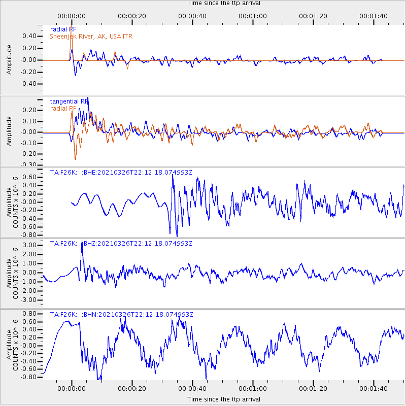
F26K Sheenjek River, AK, USA - Earthquake Result Viewer
*The percent match for this event was below the threshold and hence no stack was calculated.
| Earthquake location: |
Northeast Of Taiwan |
| Earthquake latitude/longitude: |
26.1/125.1 |
| Earthquake time(UTC): |
2021/03/26 (085) 22:02:15 GMT |
| Earthquake Depth: |
147 km |
| Earthquake Magnitude: |
5.9 mww |
| Earthquake Catalog/Contributor: |
NEIC PDE/us |
|
| Network: |
TA USArray Transportable Network (new EarthScope stations) |
| Station: |
F26K Sheenjek River, AK, USA |
| Lat/Lon: |
67.69 N/144.15 W |
| Elevation: |
683 m |
|
| Distance: |
66.4 deg |
| Az: |
24.614 deg |
| Baz: |
281.228 deg |
| Ray Param: |
$rayparam |
*The percent match for this event was below the threshold and hence was not used in the summary stack. |
|
| Radial Match: |
82.88894 % |
| Radial Bump: |
400 |
| Transverse Match: |
90.627464 % |
| Transverse Bump: |
344 |
| SOD ConfigId: |
24334971 |
| Insert Time: |
2021-04-09 22:18:26.422 +0000 |
| GWidth: |
2.5 |
| Max Bumps: |
400 |
| Tol: |
0.001 |
|
Signal To Noise
| Channel | StoN | STA | LTA |
| TA:F26K: :BHZ:20210326T22:12:18.074993Z | 2.2544525 | 1.1853049E-6 | 5.257617E-7 |
| TA:F26K: :BHN:20210326T22:12:18.074993Z | 1.2648048 | 5.422486E-7 | 4.287211E-7 |
| TA:F26K: :BHE:20210326T22:12:18.074993Z | 2.167793 | 3.456414E-7 | 1.5944391E-7 |
| Arrivals |
| Ps | |
| PpPs | |
| PsPs/PpSs | |


