You are here: Home > Network List > CI - Caltech Regional Seismic Network Stations List
> Station MPM Manuel Prospect Mine, California, USA > Earthquake Result Viewer
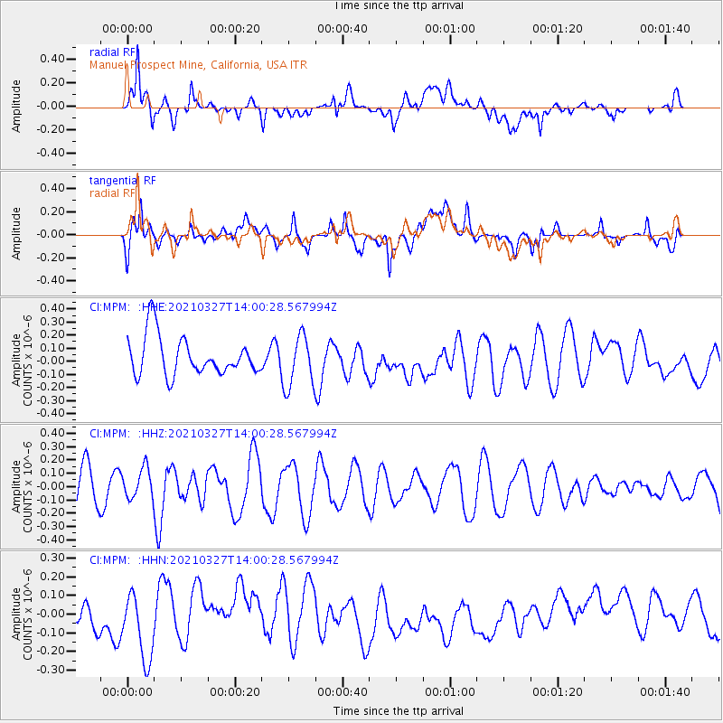
MPM Manuel Prospect Mine, California, USA - Earthquake Result Viewer
*The percent match for this event was below the threshold and hence no stack was calculated.
| Earthquake location: |
Adriatic Sea |
| Earthquake latitude/longitude: |
42.4/16.0 |
| Earthquake time(UTC): |
2021/03/27 (086) 13:47:55 GMT |
| Earthquake Depth: |
10 km |
| Earthquake Magnitude: |
5.5 mww |
| Earthquake Catalog/Contributor: |
NEIC PDE/us |
|
| Network: |
CI Caltech Regional Seismic Network |
| Station: |
MPM Manuel Prospect Mine, California, USA |
| Lat/Lon: |
36.06 N/117.49 W |
| Elevation: |
185 m |
|
| Distance: |
91.1 deg |
| Az: |
324.018 deg |
| Baz: |
32.46 deg |
| Ray Param: |
$rayparam |
*The percent match for this event was below the threshold and hence was not used in the summary stack. |
|
| Radial Match: |
57.27582 % |
| Radial Bump: |
400 |
| Transverse Match: |
56.667976 % |
| Transverse Bump: |
400 |
| SOD ConfigId: |
24334971 |
| Insert Time: |
2021-04-10 13:57:13.687 +0000 |
| GWidth: |
2.5 |
| Max Bumps: |
400 |
| Tol: |
0.001 |
|
Signal To Noise
| Channel | StoN | STA | LTA |
| CI:MPM: :HHZ:20210327T14:00:28.567994Z | 0.75060153 | 1.1497102E-7 | 1.5317185E-7 |
| CI:MPM: :HHN:20210327T14:00:28.567994Z | 2.8064547 | 1.8559376E-7 | 6.613104E-8 |
| CI:MPM: :HHE:20210327T14:00:28.567994Z | 1.3421711 | 1.9986793E-7 | 1.489139E-7 |
| Arrivals |
| Ps | |
| PpPs | |
| PsPs/PpSs | |


