KASH XW.KASH - Earthquake Result Viewer
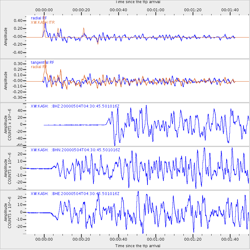
Earthquake location: Sulawesi, Indonesia
Earthquake latitude/longitude: -1.1/123.6
Earthquake time(UTC): 2000/05/04 (125) 04:21:16 GMT
Earthquake Depth: 26 km
Earthquake Magnitude: 6.7 MB, 7.5 MS, 7.6 MW, 7.5 ME
Earthquake Catalog/Contributor: WHDF/NEIC
Network: XW Tien Shan Continental Dynamics
Station: KASH XW.KASH
Lat/Lon: 39.52 N/75.92 E
Elevation: 1310 m
Distance: 59.4 deg
Az: 318.389 deg
Baz: 120.869 deg
Ray Param: 0.062167197
Estimated Moho Depth: 20.75 km
Estimated Crust Vp/Vs: 1.97
Assumed Crust Vp: 6.472 km/s
Estimated Crust Vs: 3.294 km/s
Estimated Crust Poisson's Ratio: 0.33
Radial Match: 83.112274 %
Radial Bump: 400
Transverse Match: 73.800735 %
Transverse Bump: 400
SOD ConfigId: 20082
Insert Time: 2010-02-26 15:28:07.504 +0000
GWidth: 2.5
Max Bumps: 400
Tol: 0.001

Signal To Noise

ChannelStoNSTALTA
XW:KASH: :BHN:20000504T04:30:45.501016Z3.09689476.5134685E-72.1032257E-7
XW:KASH: :BHE:20000504T04:30:45.501016Z5.81430241.0961022E-61.8851826E-7
XW:KASH: :BHZ:20000504T04:30:45.501016Z31.5614935.657561E-61.7925518E-7
Arrivals
Ps3.2 SECOND
PpPs9.1 SECOND
PsPs/PpSs12 SECOND