You are here: Home > Network List > G - GEOSCOPE Stations List
> Station INU Inuyama, Japan > Earthquake Result Viewer
INU Inuyama, Japan - Earthquake Result Viewer
*The percent match for this event was below the threshold and hence no stack was calculated.
| Earthquake location: |
Adriatic Sea |
| Earthquake latitude/longitude: |
42.4/16.0 |
| Earthquake time(UTC): |
2021/03/27 (086) 13:47:55 GMT |
| Earthquake Depth: |
10 km |
| Earthquake Magnitude: |
5.5 mww |
| Earthquake Catalog/Contributor: |
NEIC PDE/us |
|
| Network: |
G GEOSCOPE |
| Station: |
INU Inuyama, Japan |
| Lat/Lon: |
35.35 N/137.03 E |
| Elevation: |
132 m |
|
| Distance: |
85.7 deg |
| Az: |
44.656 deg |
| Baz: |
320.474 deg |
| Ray Param: |
$rayparam |
*The percent match for this event was below the threshold and hence was not used in the summary stack. |
|
| Radial Match: |
66.218506 % |
| Radial Bump: |
400 |
| Transverse Match: |
68.63335 % |
| Transverse Bump: |
400 |
| SOD ConfigId: |
24334971 |
| Insert Time: |
2021-04-10 14:00:18.383 +0000 |
| GWidth: |
2.5 |
| Max Bumps: |
400 |
| Tol: |
0.001 |
|
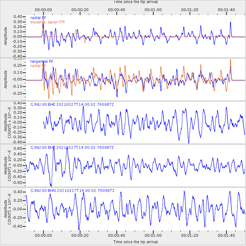
Signal To Noise
| Channel | StoN | STA | LTA |
| G:INU:00:BHZ:20210327T14:00:02.760987Z | 1.9466552 | 3.5360165E-7 | 1.8164576E-7 |
| G:INU:00:BHN:20210327T14:00:02.760987Z | 1.0663431 | 1.8840457E-7 | 1.7668289E-7 |
| G:INU:00:BHE:20210327T14:00:02.760987Z | 1.3561058 | 1.4841699E-7 | 1.0944351E-7 |
| Arrivals |
| Ps | |
| PpPs | |
| PsPs/PpSs | |


