You are here: Home > Network List > GS - US Geological Survey Networks Stations List
> Station DEC09 Kile Street Surface Site > Earthquake Result Viewer
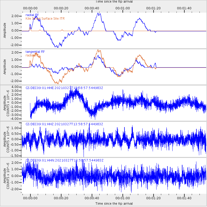
DEC09 Kile Street Surface Site - Earthquake Result Viewer
*The percent match for this event was below the threshold and hence no stack was calculated.
| Earthquake location: |
Adriatic Sea |
| Earthquake latitude/longitude: |
42.4/16.0 |
| Earthquake time(UTC): |
2021/03/27 (086) 13:47:55 GMT |
| Earthquake Depth: |
10 km |
| Earthquake Magnitude: |
5.5 mww |
| Earthquake Catalog/Contributor: |
NEIC PDE/us |
|
| Network: |
GS US Geological Survey Networks |
| Station: |
DEC09 Kile Street Surface Site |
| Lat/Lon: |
39.87 N/88.92 W |
| Elevation: |
207 m |
|
| Distance: |
73.6 deg |
| Az: |
309.2 deg |
| Baz: |
48.191 deg |
| Ray Param: |
$rayparam |
*The percent match for this event was below the threshold and hence was not used in the summary stack. |
|
| Radial Match: |
40.957077 % |
| Radial Bump: |
400 |
| Transverse Match: |
43.160744 % |
| Transverse Bump: |
400 |
| SOD ConfigId: |
24334971 |
| Insert Time: |
2021-04-10 14:00:45.542 +0000 |
| GWidth: |
2.5 |
| Max Bumps: |
400 |
| Tol: |
0.001 |
|
Signal To Noise
| Channel | StoN | STA | LTA |
| GS:DEC09:01:HHZ:20210327T13:58:57.544983Z | 1.1338733 | 4.4666967E-7 | 3.939326E-7 |
| GS:DEC09:01:HHN:20210327T13:58:57.544983Z | 1.9986196 | 1.3815595E-6 | 6.9125684E-7 |
| GS:DEC09:01:HHE:20210327T13:58:57.544983Z | 2.427618 | 2.6444663E-6 | 1.0893256E-6 |
| Arrivals |
| Ps | |
| PpPs | |
| PsPs/PpSs | |


