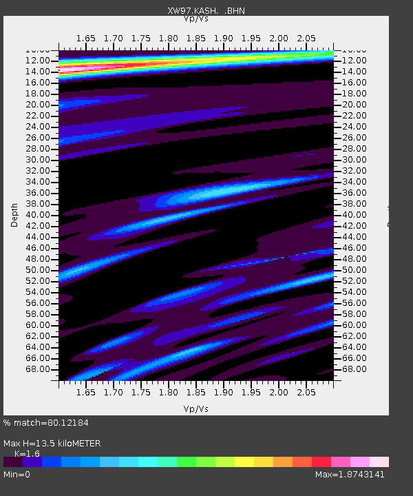
KASH XW.KASH - Earthquake Result Viewer

Earthquake location: Kuril Islands
Earthquake latitude/longitude: 43.0/146.8
Earthquake time(UTC): 2000/01/28 (028) 14:21:07 GMT
Earthquake Depth: 61 km
Earthquake Magnitude: 6.7 MB, 6.6 MS, 6.8 MW, 6.8 ME
Earthquake Catalog/Contributor: WHDF/NEIC
Network: XW Tien Shan Continental Dynamics
Station: KASH XW.KASH
Lat/Lon: 39.52 N/75.92 E
Elevation: 1310 m
Distance: 51.9 deg
Az: 291.812 deg
Baz: 61.626 deg
Ray Param: 0.06691341
Estimated Moho Depth: 13.5 km
Estimated Crust Vp/Vs: 1.60
Assumed Crust Vp: 6.472 km/s
Estimated Crust Vs: 4.045 km/s
Estimated Crust Poisson's Ratio: 0.18
Radial Match: 80.12184 %
Radial Bump: 400
Transverse Match: 82.052986 %
Transverse Bump: 400
SOD ConfigId: 20082
Insert Time: 2010-02-26 15:28:12.153 +0000
GWidth: 2.5
Max Bumps: 400
Tol: 0.001

Signal To Noise

ChannelStoNSTALTA
XW:KASH: :BHN:20000128T14:29:39.47501Z3.90053349.2479155E-72.370936E-7
XW:KASH: :BHE:20000128T14:29:39.47501Z6.99859141.5091148E-62.1563122E-7
XW:KASH: :BHZ:20000128T14:29:39.47501Z36.230966.1253872E-61.6906499E-7
Arrivals
Ps1.3 SECOND
PpPs5.1 SECOND
PsPs/PpSs6.4 SECOND