You are here: Home > Network List > TA - USArray Transportable Network (new EarthScope stations) Stations List
> Station F26K Sheenjek River, AK, USA > Earthquake Result Viewer
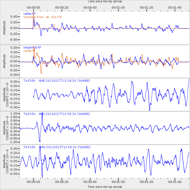
F26K Sheenjek River, AK, USA - Earthquake Result Viewer
*The percent match for this event was below the threshold and hence no stack was calculated.
| Earthquake location: |
Adriatic Sea |
| Earthquake latitude/longitude: |
42.4/16.0 |
| Earthquake time(UTC): |
2021/03/27 (086) 13:47:55 GMT |
| Earthquake Depth: |
10 km |
| Earthquake Magnitude: |
5.5 mww |
| Earthquake Catalog/Contributor: |
NEIC PDE/us |
|
| Network: |
TA USArray Transportable Network (new EarthScope stations) |
| Station: |
F26K Sheenjek River, AK, USA |
| Lat/Lon: |
67.69 N/144.15 W |
| Elevation: |
683 m |
|
| Distance: |
69.2 deg |
| Az: |
352.045 deg |
| Baz: |
15.567 deg |
| Ray Param: |
$rayparam |
*The percent match for this event was below the threshold and hence was not used in the summary stack. |
|
| Radial Match: |
58.22797 % |
| Radial Bump: |
400 |
| Transverse Match: |
58.665924 % |
| Transverse Bump: |
400 |
| SOD ConfigId: |
24334971 |
| Insert Time: |
2021-04-10 14:10:08.366 +0000 |
| GWidth: |
2.5 |
| Max Bumps: |
400 |
| Tol: |
0.001 |
|
Signal To Noise
| Channel | StoN | STA | LTA |
| TA:F26K: :BHZ:20210327T13:58:30.799988Z | 6.489112 | 4.5756423E-7 | 7.051261E-8 |
| TA:F26K: :BHN:20210327T13:58:30.799988Z | 2.0664816 | 1.42799E-7 | 6.910248E-8 |
| TA:F26K: :BHE:20210327T13:58:30.799988Z | 0.8164997 | 4.4267043E-8 | 5.4215626E-8 |
| Arrivals |
| Ps | |
| PpPs | |
| PsPs/PpSs | |


