You are here: Home > Network List > TA - USArray Transportable Network (new EarthScope stations) Stations List
> Station G21K Allakaket, AK, USA > Earthquake Result Viewer
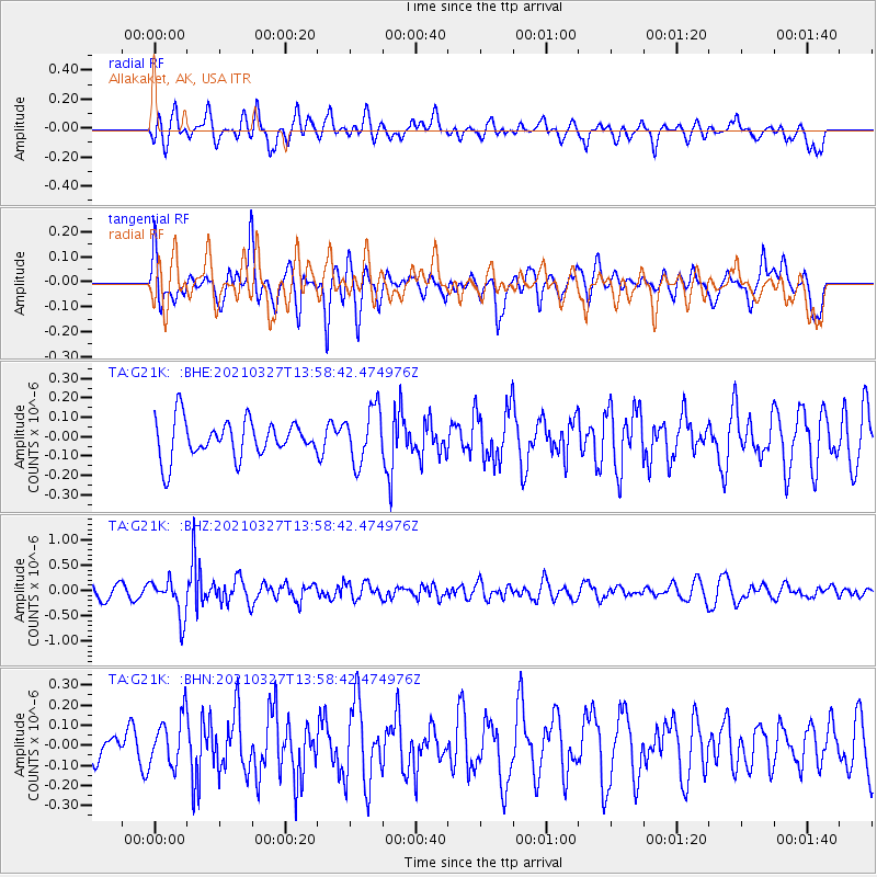
G21K Allakaket, AK, USA - Earthquake Result Viewer
*The percent match for this event was below the threshold and hence no stack was calculated.
| Earthquake location: |
Adriatic Sea |
| Earthquake latitude/longitude: |
42.4/16.0 |
| Earthquake time(UTC): |
2021/03/27 (086) 13:47:55 GMT |
| Earthquake Depth: |
10 km |
| Earthquake Magnitude: |
5.5 mww |
| Earthquake Catalog/Contributor: |
NEIC PDE/us |
|
| Network: |
TA USArray Transportable Network (new EarthScope stations) |
| Station: |
G21K Allakaket, AK, USA |
| Lat/Lon: |
66.52 N/153.51 W |
| Elevation: |
446 m |
|
| Distance: |
71.1 deg |
| Az: |
355.594 deg |
| Baz: |
8.157 deg |
| Ray Param: |
$rayparam |
*The percent match for this event was below the threshold and hence was not used in the summary stack. |
|
| Radial Match: |
51.396698 % |
| Radial Bump: |
400 |
| Transverse Match: |
62.819736 % |
| Transverse Bump: |
400 |
| SOD ConfigId: |
24334971 |
| Insert Time: |
2021-04-10 14:10:18.735 +0000 |
| GWidth: |
2.5 |
| Max Bumps: |
400 |
| Tol: |
0.001 |
|
Signal To Noise
| Channel | StoN | STA | LTA |
| TA:G21K: :BHZ:20210327T13:58:42.474976Z | 3.584968 | 3.7199857E-7 | 1.0376622E-7 |
| TA:G21K: :BHN:20210327T13:58:42.474976Z | 1.1728008 | 1.2410092E-7 | 1.0581586E-7 |
| TA:G21K: :BHE:20210327T13:58:42.474976Z | 1.471688 | 1.4092011E-7 | 9.575406E-8 |
| Arrivals |
| Ps | |
| PpPs | |
| PsPs/PpSs | |


