You are here: Home > Network List > TA - USArray Transportable Network (new EarthScope stations) Stations List
> Station I30M Mount Dempster, Yukon, CAN > Earthquake Result Viewer
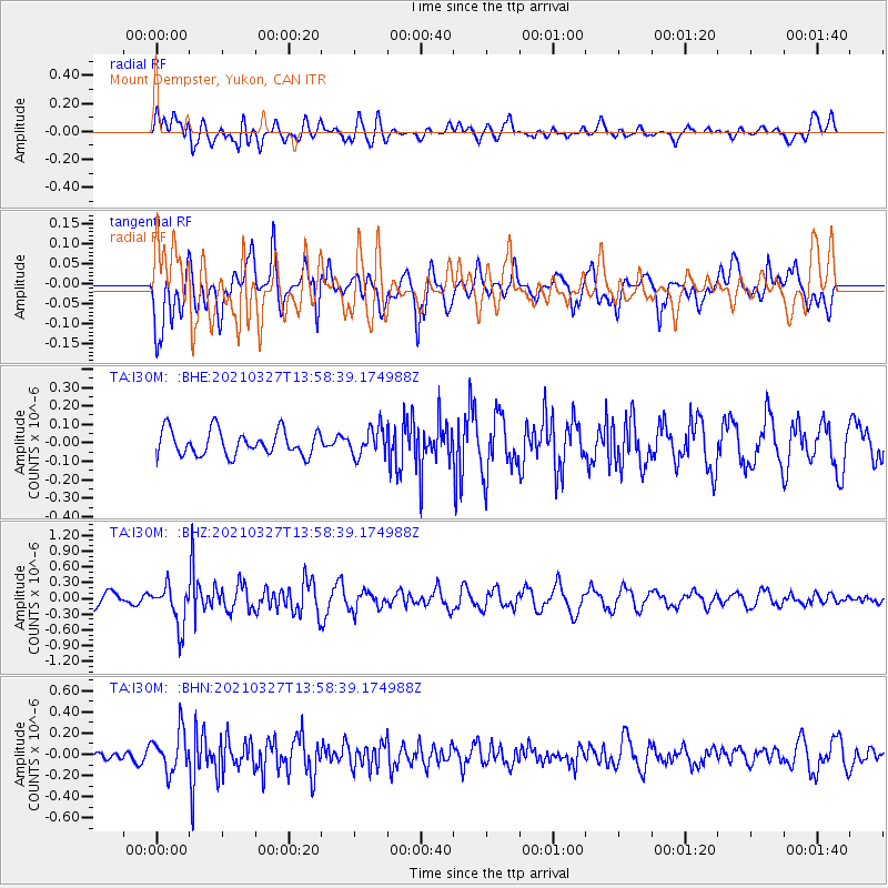
I30M Mount Dempster, Yukon, CAN - Earthquake Result Viewer
*The percent match for this event was below the threshold and hence no stack was calculated.
| Earthquake location: |
Adriatic Sea |
| Earthquake latitude/longitude: |
42.4/16.0 |
| Earthquake time(UTC): |
2021/03/27 (086) 13:47:55 GMT |
| Earthquake Depth: |
10 km |
| Earthquake Magnitude: |
5.5 mww |
| Earthquake Catalog/Contributor: |
NEIC PDE/us |
|
| Network: |
TA USArray Transportable Network (new EarthScope stations) |
| Station: |
I30M Mount Dempster, Yukon, CAN |
| Lat/Lon: |
65.22 N/136.38 W |
| Elevation: |
1399 m |
|
| Distance: |
70.5 deg |
| Az: |
348.058 deg |
| Baz: |
21.312 deg |
| Ray Param: |
$rayparam |
*The percent match for this event was below the threshold and hence was not used in the summary stack. |
|
| Radial Match: |
57.15007 % |
| Radial Bump: |
400 |
| Transverse Match: |
67.75839 % |
| Transverse Bump: |
400 |
| SOD ConfigId: |
24334971 |
| Insert Time: |
2021-04-10 14:10:38.239 +0000 |
| GWidth: |
2.5 |
| Max Bumps: |
400 |
| Tol: |
0.001 |
|
Signal To Noise
| Channel | StoN | STA | LTA |
| TA:I30M: :BHZ:20210327T13:58:39.174988Z | 3.2455215 | 3.924124E-7 | 1.209089E-7 |
| TA:I30M: :BHN:20210327T13:58:39.174988Z | 2.0716958 | 1.8988884E-7 | 9.165864E-8 |
| TA:I30M: :BHE:20210327T13:58:39.174988Z | 1.094984 | 7.4405406E-8 | 6.7951134E-8 |
| Arrivals |
| Ps | |
| PpPs | |
| PsPs/PpSs | |


