You are here: Home > Network List > US - United States National Seismic Network Stations List
> Station DGMT Dagmar, Montana, USA > Earthquake Result Viewer
DGMT Dagmar, Montana, USA - Earthquake Result Viewer

| Earthquake location: |
Adriatic Sea |
| Earthquake latitude/longitude: |
42.4/16.0 |
| Earthquake time(UTC): |
2021/03/27 (086) 13:47:55 GMT |
| Earthquake Depth: |
10 km |
| Earthquake Magnitude: |
5.5 mww |
| Earthquake Catalog/Contributor: |
NEIC PDE/us |
|
| Network: |
US United States National Seismic Network |
| Station: |
DGMT Dagmar, Montana, USA |
| Lat/Lon: |
48.47 N/104.20 W |
| Elevation: |
0.0 m |
|
| Distance: |
75.3 deg |
| Az: |
323.531 deg |
| Baz: |
41.384 deg |
| Ray Param: |
0.051764738 |
| Estimated Moho Depth: |
47.5 km |
| Estimated Crust Vp/Vs: |
1.73 |
| Assumed Crust Vp: |
6.438 km/s |
| Estimated Crust Vs: |
3.726 km/s |
| Estimated Crust Poisson's Ratio: |
0.25 |
|
| Radial Match: |
82.49797 % |
| Radial Bump: |
237 |
| Transverse Match: |
48.718258 % |
| Transverse Bump: |
360 |
| SOD ConfigId: |
24334971 |
| Insert Time: |
2021-04-10 14:13:12.795 +0000 |
| GWidth: |
2.5 |
| Max Bumps: |
400 |
| Tol: |
0.001 |
|
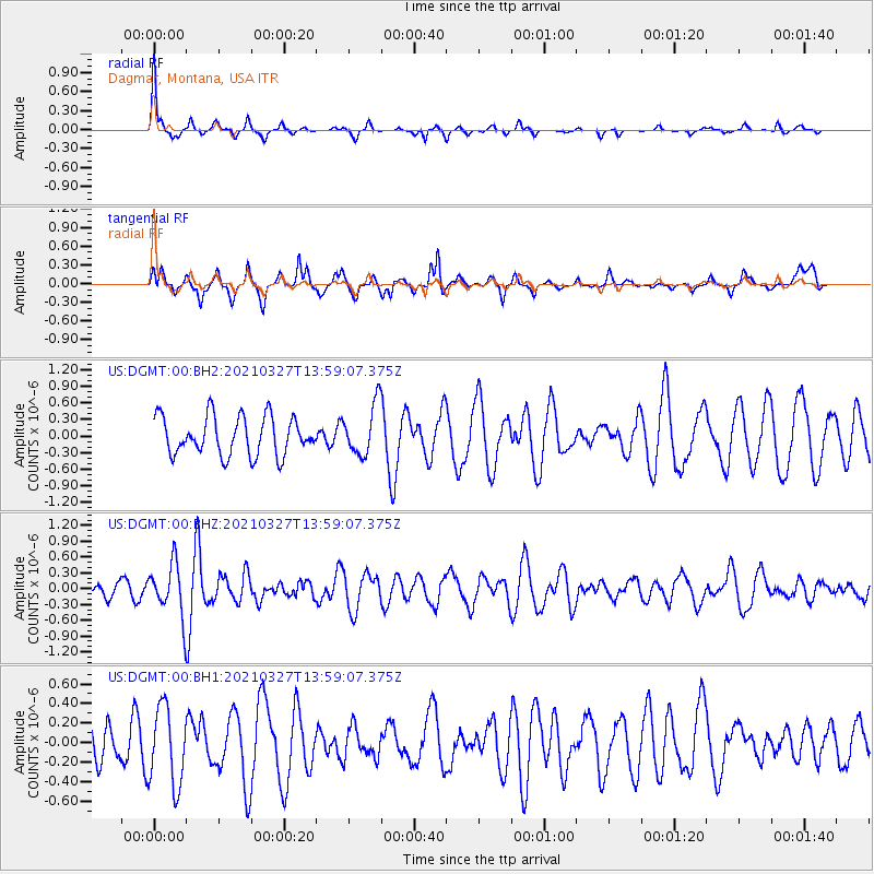
Signal To Noise
| Channel | StoN | STA | LTA |
| US:DGMT:00:BHZ:20210327T13:59:07.375Z | 2.2514846 | 4.8647115E-7 | 2.1606682E-7 |
| US:DGMT:00:BH1:20210327T13:59:07.375Z | 1.2402284 | 4.0214294E-7 | 3.242491E-7 |
| US:DGMT:00:BH2:20210327T13:59:07.375Z | 1.3242172 | 4.601269E-7 | 3.4747086E-7 |
| Arrivals |
| Ps | 5.6 SECOND |
| PpPs | 19 SECOND |
| PsPs/PpSs | 25 SECOND |


