You are here: Home > Network List > US - United States National Seismic Network Stations List
> Station EGMT Eagleton, Montana, USA > Earthquake Result Viewer
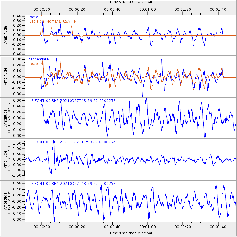
EGMT Eagleton, Montana, USA - Earthquake Result Viewer
*The percent match for this event was below the threshold and hence no stack was calculated.
| Earthquake location: |
Adriatic Sea |
| Earthquake latitude/longitude: |
42.4/16.0 |
| Earthquake time(UTC): |
2021/03/27 (086) 13:47:55 GMT |
| Earthquake Depth: |
10 km |
| Earthquake Magnitude: |
5.5 mww |
| Earthquake Catalog/Contributor: |
NEIC PDE/us |
|
| Network: |
US United States National Seismic Network |
| Station: |
EGMT Eagleton, Montana, USA |
| Lat/Lon: |
48.02 N/109.75 W |
| Elevation: |
1055 m |
|
| Distance: |
78.0 deg |
| Az: |
326.18 deg |
| Baz: |
37.859 deg |
| Ray Param: |
$rayparam |
*The percent match for this event was below the threshold and hence was not used in the summary stack. |
|
| Radial Match: |
66.497765 % |
| Radial Bump: |
400 |
| Transverse Match: |
63.172173 % |
| Transverse Bump: |
398 |
| SOD ConfigId: |
24334971 |
| Insert Time: |
2021-04-10 14:13:15.980 +0000 |
| GWidth: |
2.5 |
| Max Bumps: |
400 |
| Tol: |
0.001 |
|
Signal To Noise
| Channel | StoN | STA | LTA |
| US:EGMT:00:BHZ:20210327T13:59:22.650025Z | 3.377261 | 4.178757E-7 | 1.2373214E-7 |
| US:EGMT:00:BH1:20210327T13:59:22.650025Z | 0.5318908 | 1.1986583E-7 | 2.2535798E-7 |
| US:EGMT:00:BH2:20210327T13:59:22.650025Z | 0.8066239 | 1.7338937E-7 | 2.1495691E-7 |
| Arrivals |
| Ps | |
| PpPs | |
| PsPs/PpSs | |


