You are here: Home > Network List > GS - US Geological Survey Networks Stations List
> Station KAN10 Keim Farm > Earthquake Result Viewer
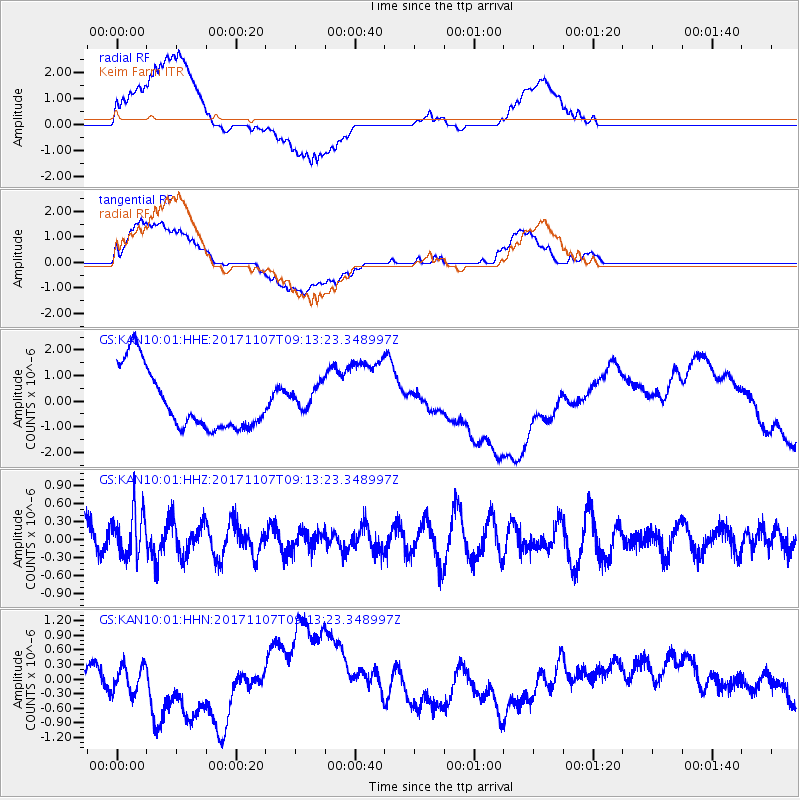
KAN10 Keim Farm - Earthquake Result Viewer
*The percent match for this event was below the threshold and hence no stack was calculated.
| Earthquake location: |
Fiji Islands Region |
| Earthquake latitude/longitude: |
-17.7/-178.5 |
| Earthquake time(UTC): |
2017/11/07 (311) 09:01:39 GMT |
| Earthquake Depth: |
555 km |
| Earthquake Magnitude: |
5.7 Mww |
| Earthquake Catalog/Contributor: |
NEIC PDE/us |
|
| Network: |
GS US Geological Survey Networks |
| Station: |
KAN10 Keim Farm |
| Lat/Lon: |
37.12 N/98.10 W |
| Elevation: |
417 m |
|
| Distance: |
93.1 deg |
| Az: |
52.127 deg |
| Baz: |
250.312 deg |
| Ray Param: |
$rayparam |
*The percent match for this event was below the threshold and hence was not used in the summary stack. |
|
| Radial Match: |
45.776897 % |
| Radial Bump: |
400 |
| Transverse Match: |
46.07997 % |
| Transverse Bump: |
400 |
| SOD ConfigId: |
2429771 |
| Insert Time: |
2017-11-21 09:02:52.993 +0000 |
| GWidth: |
2.5 |
| Max Bumps: |
400 |
| Tol: |
0.001 |
|
Signal To Noise
| Channel | StoN | STA | LTA |
| GS:KAN10:01:HHZ:20171107T09:13:23.348997Z | 1.3326132 | 3.8882214E-7 | 2.917742E-7 |
| GS:KAN10:01:HHN:20171107T09:13:23.348997Z | 1.0146108 | 3.2119775E-7 | 3.1657237E-7 |
| GS:KAN10:01:HHE:20171107T09:13:23.348997Z | 0.42423695 | 5.04372E-7 | 1.1888922E-6 |
| Arrivals |
| Ps | |
| PpPs | |
| PsPs/PpSs | |


