You are here: Home > Network List > GS - US Geological Survey Networks Stations List
> Station OK051 E0350 and S34600 Roads, Ralston, OK > Earthquake Result Viewer
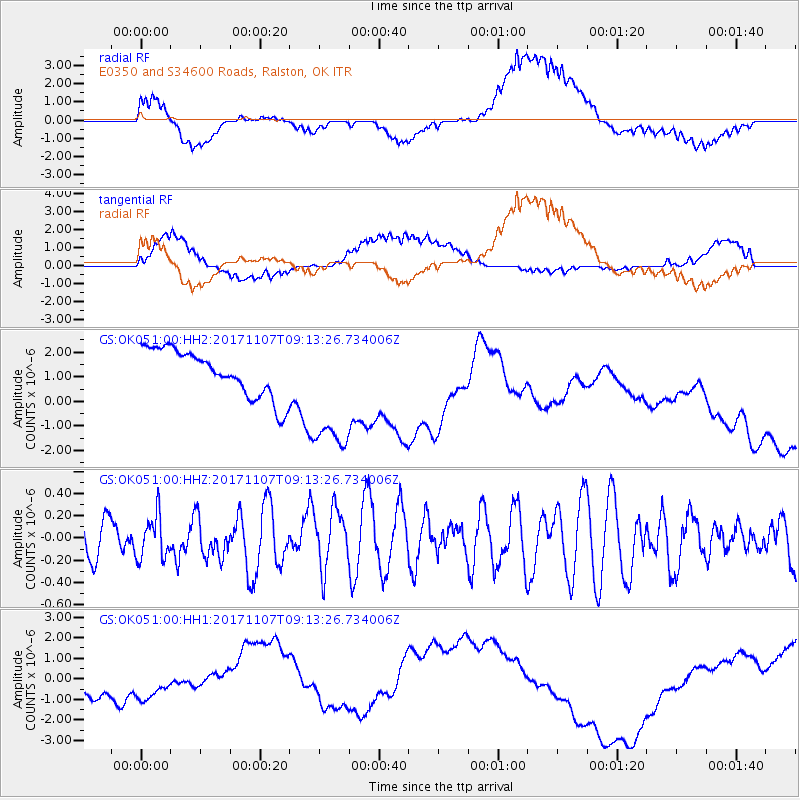
OK051 E0350 and S34600 Roads, Ralston, OK - Earthquake Result Viewer
*The percent match for this event was below the threshold and hence no stack was calculated.
| Earthquake location: |
Fiji Islands Region |
| Earthquake latitude/longitude: |
-17.7/-178.5 |
| Earthquake time(UTC): |
2017/11/07 (311) 09:01:39 GMT |
| Earthquake Depth: |
555 km |
| Earthquake Magnitude: |
5.7 Mww |
| Earthquake Catalog/Contributor: |
NEIC PDE/us |
|
| Network: |
GS US Geological Survey Networks |
| Station: |
OK051 E0350 and S34600 Roads, Ralston, OK |
| Lat/Lon: |
36.51 N/96.84 W |
| Elevation: |
263 m |
|
| Distance: |
93.9 deg |
| Az: |
53.046 deg |
| Baz: |
251.007 deg |
| Ray Param: |
$rayparam |
*The percent match for this event was below the threshold and hence was not used in the summary stack. |
|
| Radial Match: |
65.78393 % |
| Radial Bump: |
400 |
| Transverse Match: |
37.09617 % |
| Transverse Bump: |
400 |
| SOD ConfigId: |
2429771 |
| Insert Time: |
2017-11-21 09:03:05.417 +0000 |
| GWidth: |
2.5 |
| Max Bumps: |
400 |
| Tol: |
0.001 |
|
Signal To Noise
| Channel | StoN | STA | LTA |
| GS:OK051:00:HHZ:20171107T09:13:26.734006Z | 1.0779809 | 1.927714E-7 | 1.7882637E-7 |
| GS:OK051:00:HH1:20171107T09:13:26.734006Z | 1.1696665 | 3.3446128E-7 | 2.8594584E-7 |
| GS:OK051:00:HH2:20171107T09:13:26.734006Z | 2.723825 | 2.620576E-6 | 9.620941E-7 |
| Arrivals |
| Ps | |
| PpPs | |
| PsPs/PpSs | |


