KASH XW.KASH - Earthquake Result Viewer
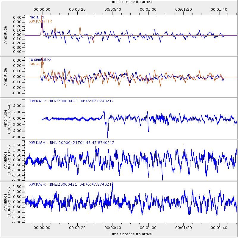
Earthquake location: Andreanof Islands, Aleutian Is.
Earthquake latitude/longitude: 51.4/-178.1
Earthquake time(UTC): 2000/04/21 (112) 04:35:17 GMT
Earthquake Depth: 33 km
Earthquake Magnitude: 6.0 MB, 5.7 MS, 6.2 ML, 6.0 MW
Earthquake Catalog/Contributor: WHDF/NEIC
Network: XW Tien Shan Continental Dynamics
Station: KASH XW.KASH
Lat/Lon: 39.52 N/75.92 E
Elevation: 1310 m
Distance: 68.8 deg
Az: 307.096 deg
Baz: 40.214 deg
Ray Param: 0.05599717
Estimated Moho Depth: 69.25 km
Estimated Crust Vp/Vs: 2.07
Assumed Crust Vp: 6.472 km/s
Estimated Crust Vs: 3.123 km/s
Estimated Crust Poisson's Ratio: 0.35
Radial Match: 81.244255 %
Radial Bump: 400
Transverse Match: 61.267982 %
Transverse Bump: 400
SOD ConfigId: 3744
Insert Time: 2010-02-26 15:28:20.139 +0000
GWidth: 2.5
Max Bumps: 400
Tol: 0.001

Signal To Noise

ChannelStoNSTALTA
XW:KASH: :BHN:20000421T04:45:47.874021Z1.44887643.6549963E-72.5226421E-7
XW:KASH: :BHE:20000421T04:45:47.874021Z0.872097732.8326005E-73.248031E-7
XW:KASH: :BHZ:20000421T04:45:47.874021Z3.29313167.3482323E-72.2313813E-7
Arrivals
Ps12 SECOND
PpPs32 SECOND
PsPs/PpSs44 SECOND