You are here: Home > Network List > AV - Alaska Volcano Observatory Stations List
> Station SPCR Ckakachatna River, Mount Spurr, Alaska > Earthquake Result Viewer
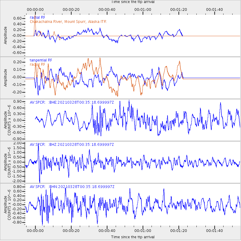
SPCR Ckakachatna River, Mount Spurr, Alaska - Earthquake Result Viewer
*The percent match for this event was below the threshold and hence no stack was calculated.
| Earthquake location: |
Southeast Of Honshu, Japan |
| Earthquake latitude/longitude: |
33.6/140.3 |
| Earthquake time(UTC): |
2021/03/28 (087) 00:26:56 GMT |
| Earthquake Depth: |
48 km |
| Earthquake Magnitude: |
5.7 mww |
| Earthquake Catalog/Contributor: |
NEIC PDE/us |
|
| Network: |
AV Alaska Volcano Observatory |
| Station: |
SPCR Ckakachatna River, Mount Spurr, Alaska |
| Lat/Lon: |
61.20 N/152.21 W |
| Elevation: |
984 m |
|
| Distance: |
50.4 deg |
| Az: |
35.477 deg |
| Baz: |
269.051 deg |
| Ray Param: |
$rayparam |
*The percent match for this event was below the threshold and hence was not used in the summary stack. |
|
| Radial Match: |
47.945305 % |
| Radial Bump: |
400 |
| Transverse Match: |
35.35559 % |
| Transverse Bump: |
400 |
| SOD ConfigId: |
24334971 |
| Insert Time: |
2021-04-11 00:32:50.141 +0000 |
| GWidth: |
2.5 |
| Max Bumps: |
400 |
| Tol: |
0.001 |
|
Signal To Noise
| Channel | StoN | STA | LTA |
| AV:SPCR: :BHZ:20210328T00:35:18.699997Z | 3.090933 | 8.2460605E-7 | 2.6678225E-7 |
| AV:SPCR: :BHN:20210328T00:35:18.699997Z | 1.5167928 | 2.8765422E-7 | 1.8964636E-7 |
| AV:SPCR: :BHE:20210328T00:35:18.699997Z | 1.688681 | 3.4744548E-7 | 2.0574963E-7 |
| Arrivals |
| Ps | |
| PpPs | |
| PsPs/PpSs | |


