You are here: Home > Network List > TA - USArray Transportable Network (new EarthScope stations) Stations List
> Station G31M Satah River, YT, CAN > Earthquake Result Viewer
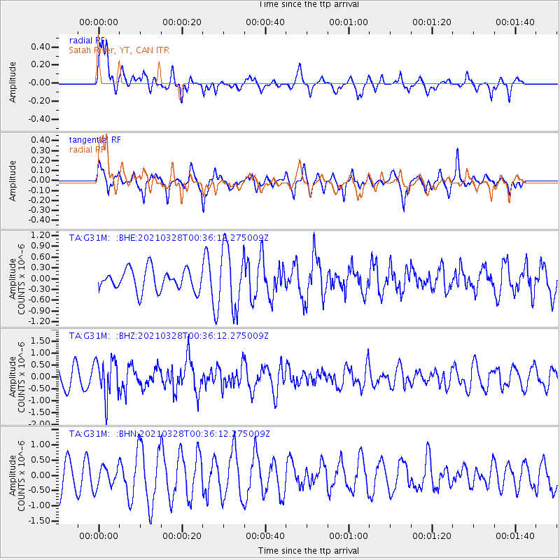
G31M Satah River, YT, CAN - Earthquake Result Viewer
*The percent match for this event was below the threshold and hence no stack was calculated.
| Earthquake location: |
Southeast Of Honshu, Japan |
| Earthquake latitude/longitude: |
33.6/140.3 |
| Earthquake time(UTC): |
2021/03/28 (087) 00:26:56 GMT |
| Earthquake Depth: |
48 km |
| Earthquake Magnitude: |
5.7 mww |
| Earthquake Catalog/Contributor: |
NEIC PDE/us |
|
| Network: |
TA USArray Transportable Network (new EarthScope stations) |
| Station: |
G31M Satah River, YT, CAN |
| Lat/Lon: |
66.92 N/134.27 W |
| Elevation: |
61 m |
|
| Distance: |
57.8 deg |
| Az: |
27.675 deg |
| Baz: |
280.617 deg |
| Ray Param: |
$rayparam |
*The percent match for this event was below the threshold and hence was not used in the summary stack. |
|
| Radial Match: |
66.10773 % |
| Radial Bump: |
400 |
| Transverse Match: |
43.49253 % |
| Transverse Bump: |
308 |
| SOD ConfigId: |
24334971 |
| Insert Time: |
2021-04-11 00:47:06.669 +0000 |
| GWidth: |
2.5 |
| Max Bumps: |
400 |
| Tol: |
0.001 |
|
Signal To Noise
| Channel | StoN | STA | LTA |
| TA:G31M: :BHZ:20210328T00:36:12.275009Z | 2.0522537 | 7.9761054E-7 | 3.8865102E-7 |
| TA:G31M: :BHN:20210328T00:36:12.275009Z | 0.5573157 | 3.248978E-7 | 5.8296905E-7 |
| TA:G31M: :BHE:20210328T00:36:12.275009Z | 2.875569 | 8.494805E-7 | 2.9541297E-7 |
| Arrivals |
| Ps | |
| PpPs | |
| PsPs/PpSs | |


