You are here: Home > Network List > US - United States National Seismic Network Stations List
> Station DGMT Dagmar, Montana, USA > Earthquake Result Viewer
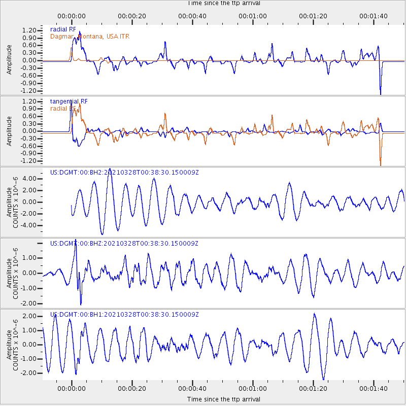
DGMT Dagmar, Montana, USA - Earthquake Result Viewer
*The percent match for this event was below the threshold and hence no stack was calculated.
| Earthquake location: |
Southeast Of Honshu, Japan |
| Earthquake latitude/longitude: |
33.6/140.3 |
| Earthquake time(UTC): |
2021/03/28 (087) 00:26:56 GMT |
| Earthquake Depth: |
48 km |
| Earthquake Magnitude: |
5.7 mww |
| Earthquake Catalog/Contributor: |
NEIC PDE/us |
|
| Network: |
US United States National Seismic Network |
| Station: |
DGMT Dagmar, Montana, USA |
| Lat/Lon: |
48.47 N/104.20 W |
| Elevation: |
0.0 m |
|
| Distance: |
80.1 deg |
| Az: |
37.588 deg |
| Baz: |
310.127 deg |
| Ray Param: |
$rayparam |
*The percent match for this event was below the threshold and hence was not used in the summary stack. |
|
| Radial Match: |
46.166386 % |
| Radial Bump: |
400 |
| Transverse Match: |
81.19156 % |
| Transverse Bump: |
400 |
| SOD ConfigId: |
24334971 |
| Insert Time: |
2021-04-11 00:49:29.003 +0000 |
| GWidth: |
2.5 |
| Max Bumps: |
400 |
| Tol: |
0.001 |
|
Signal To Noise
| Channel | StoN | STA | LTA |
| US:DGMT:00:BHZ:20210328T00:38:30.150009Z | 2.8030508 | 9.979269E-7 | 3.5601454E-7 |
| US:DGMT:00:BH1:20210328T00:38:30.150009Z | 0.9756649 | 1.2510488E-6 | 1.2822526E-6 |
| US:DGMT:00:BH2:20210328T00:38:30.150009Z | 0.841387 | 2.3010687E-6 | 2.7348517E-6 |
| Arrivals |
| Ps | |
| PpPs | |
| PsPs/PpSs | |


