You are here: Home > Network List > US - United States National Seismic Network Stations List
> Station EGMT Eagleton, Montana, USA > Earthquake Result Viewer
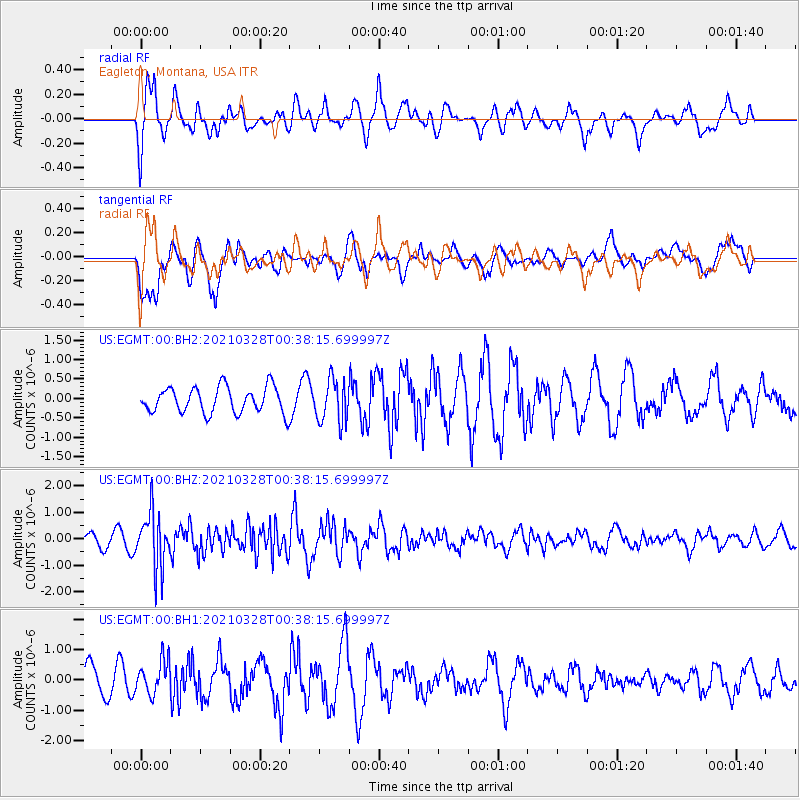
EGMT Eagleton, Montana, USA - Earthquake Result Viewer
*The percent match for this event was below the threshold and hence no stack was calculated.
| Earthquake location: |
Southeast Of Honshu, Japan |
| Earthquake latitude/longitude: |
33.6/140.3 |
| Earthquake time(UTC): |
2021/03/28 (087) 00:26:56 GMT |
| Earthquake Depth: |
48 km |
| Earthquake Magnitude: |
5.7 mww |
| Earthquake Catalog/Contributor: |
NEIC PDE/us |
|
| Network: |
US United States National Seismic Network |
| Station: |
EGMT Eagleton, Montana, USA |
| Lat/Lon: |
48.02 N/109.75 W |
| Elevation: |
1055 m |
|
| Distance: |
77.4 deg |
| Az: |
40.293 deg |
| Baz: |
306.519 deg |
| Ray Param: |
$rayparam |
*The percent match for this event was below the threshold and hence was not used in the summary stack. |
|
| Radial Match: |
52.961296 % |
| Radial Bump: |
400 |
| Transverse Match: |
67.1349 % |
| Transverse Bump: |
400 |
| SOD ConfigId: |
24334971 |
| Insert Time: |
2021-04-11 00:49:32.543 +0000 |
| GWidth: |
2.5 |
| Max Bumps: |
400 |
| Tol: |
0.001 |
|
Signal To Noise
| Channel | StoN | STA | LTA |
| US:EGMT:00:BHZ:20210328T00:38:15.699997Z | 5.0487547 | 1.0473099E-6 | 2.0743926E-7 |
| US:EGMT:00:BH1:20210328T00:38:15.699997Z | 1.1120319 | 5.4845907E-7 | 4.932044E-7 |
| US:EGMT:00:BH2:20210328T00:38:15.699997Z | 1.6513885 | 5.4990596E-7 | 3.329961E-7 |
| Arrivals |
| Ps | |
| PpPs | |
| PsPs/PpSs | |


