You are here: Home > Network List > UU - University of Utah Regional Network Stations List
> Station KNB Kanab, UT, USA > Earthquake Result Viewer
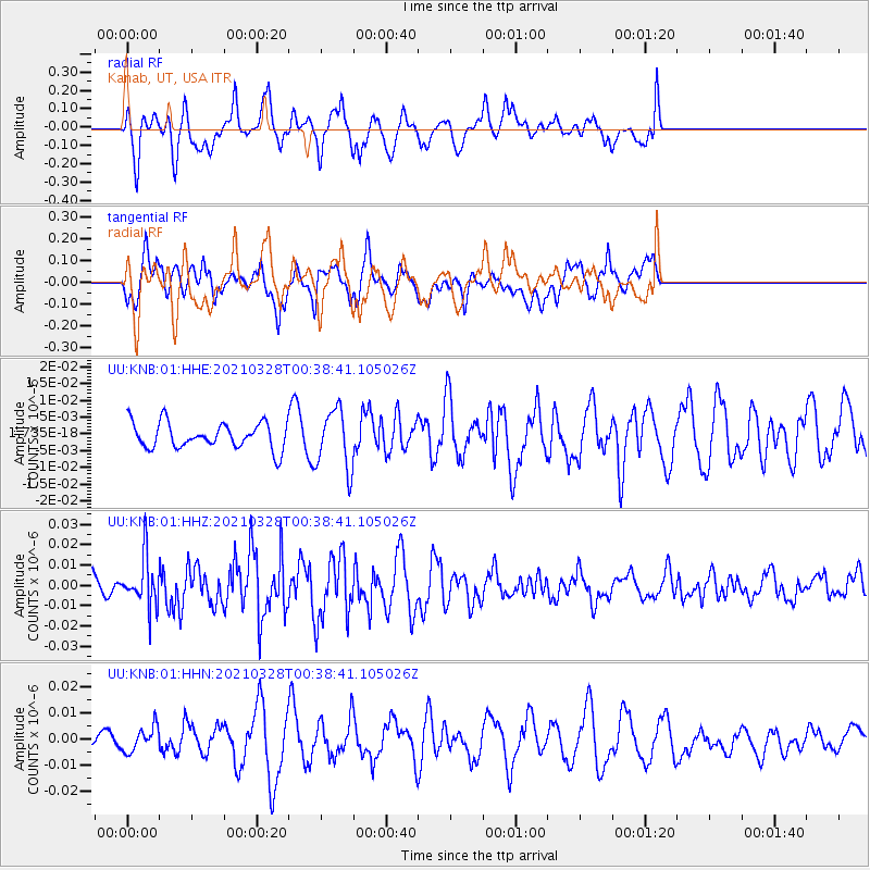
KNB Kanab, UT, USA - Earthquake Result Viewer
*The percent match for this event was below the threshold and hence no stack was calculated.
| Earthquake location: |
Southeast Of Honshu, Japan |
| Earthquake latitude/longitude: |
33.6/140.3 |
| Earthquake time(UTC): |
2021/03/28 (087) 00:26:56 GMT |
| Earthquake Depth: |
48 km |
| Earthquake Magnitude: |
5.7 mww |
| Earthquake Catalog/Contributor: |
NEIC PDE/us |
|
| Network: |
UU University of Utah Regional Network |
| Station: |
KNB Kanab, UT, USA |
| Lat/Lon: |
37.02 N/112.82 W |
| Elevation: |
1715 m |
|
| Distance: |
82.1 deg |
| Az: |
50.655 deg |
| Baz: |
306.291 deg |
| Ray Param: |
$rayparam |
*The percent match for this event was below the threshold and hence was not used in the summary stack. |
|
| Radial Match: |
60.533604 % |
| Radial Bump: |
400 |
| Transverse Match: |
50.64135 % |
| Transverse Bump: |
394 |
| SOD ConfigId: |
24334971 |
| Insert Time: |
2021-04-11 00:50:10.316 +0000 |
| GWidth: |
2.5 |
| Max Bumps: |
400 |
| Tol: |
0.001 |
|
Signal To Noise
| Channel | StoN | STA | LTA |
| UU:KNB:01:HHZ:20210328T00:38:41.105026Z | 2.3098402 | 1.241005E-8 | 5.3726876E-9 |
| UU:KNB:01:HHN:20210328T00:38:41.105026Z | 1.2193004 | 4.768931E-9 | 3.911203E-9 |
| UU:KNB:01:HHE:20210328T00:38:41.105026Z | 2.3044093 | 8.878791E-9 | 3.8529575E-9 |
| Arrivals |
| Ps | |
| PpPs | |
| PsPs/PpSs | |


