You are here: Home > Network List > WY - Yellowstone Wyoming Seismic Network Stations List
> Station YHH Holmes Hill, YNP, WY, USA > Earthquake Result Viewer
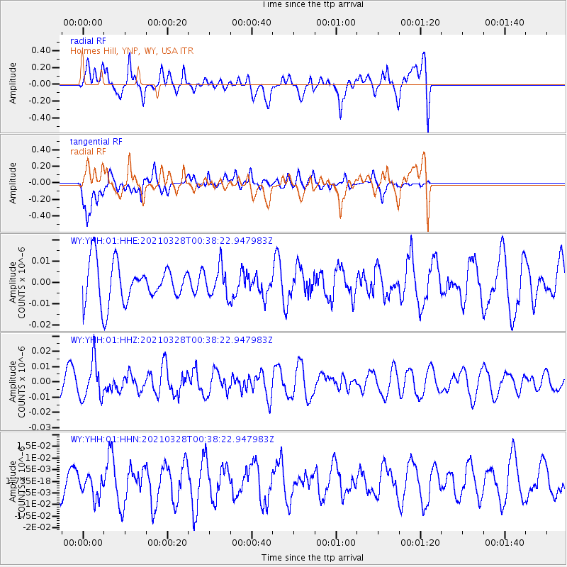
YHH Holmes Hill, YNP, WY, USA - Earthquake Result Viewer
*The percent match for this event was below the threshold and hence no stack was calculated.
| Earthquake location: |
Southeast Of Honshu, Japan |
| Earthquake latitude/longitude: |
33.6/140.3 |
| Earthquake time(UTC): |
2021/03/28 (087) 00:26:56 GMT |
| Earthquake Depth: |
48 km |
| Earthquake Magnitude: |
5.7 mww |
| Earthquake Catalog/Contributor: |
NEIC PDE/us |
|
| Network: |
WY Yellowstone Wyoming Seismic Network |
| Station: |
YHH Holmes Hill, YNP, WY, USA |
| Lat/Lon: |
44.79 N/110.85 W |
| Elevation: |
2717 m |
|
| Distance: |
78.7 deg |
| Az: |
43.415 deg |
| Baz: |
306.373 deg |
| Ray Param: |
$rayparam |
*The percent match for this event was below the threshold and hence was not used in the summary stack. |
|
| Radial Match: |
62.610203 % |
| Radial Bump: |
400 |
| Transverse Match: |
51.48694 % |
| Transverse Bump: |
400 |
| SOD ConfigId: |
24334971 |
| Insert Time: |
2021-04-11 00:52:07.221 +0000 |
| GWidth: |
2.5 |
| Max Bumps: |
400 |
| Tol: |
0.001 |
|
Signal To Noise
| Channel | StoN | STA | LTA |
| WY:YHH:01:HHZ:20210328T00:38:22.947983Z | 1.7868881 | 1.2754284E-8 | 7.137707E-9 |
| WY:YHH:01:HHN:20210328T00:38:22.947983Z | 0.68977475 | 5.26185E-9 | 7.62836E-9 |
| WY:YHH:01:HHE:20210328T00:38:22.947983Z | 0.74311966 | 6.8941435E-9 | 9.277299E-9 |
| Arrivals |
| Ps | |
| PpPs | |
| PsPs/PpSs | |


