You are here: Home > Network List > AV - Alaska Volcano Observatory Stations List
> Station SPCR Ckakachatna River, Mount Spurr, Alaska > Earthquake Result Viewer
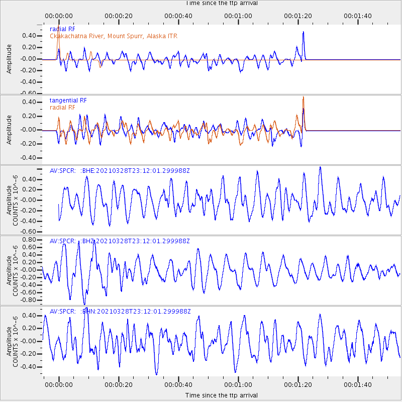
SPCR Ckakachatna River, Mount Spurr, Alaska - Earthquake Result Viewer
*The percent match for this event was below the threshold and hence no stack was calculated.
| Earthquake location: |
Northern Mid-Atlantic Ridge |
| Earthquake latitude/longitude: |
43.6/-28.8 |
| Earthquake time(UTC): |
2021/03/28 (087) 23:01:46 GMT |
| Earthquake Depth: |
10 km |
| Earthquake Magnitude: |
5.8 Mww |
| Earthquake Catalog/Contributor: |
NEIC PDE/us |
|
| Network: |
AV Alaska Volcano Observatory |
| Station: |
SPCR Ckakachatna River, Mount Spurr, Alaska |
| Lat/Lon: |
61.20 N/152.21 W |
| Elevation: |
984 m |
|
| Distance: |
65.9 deg |
| Az: |
333.725 deg |
| Baz: |
41.578 deg |
| Ray Param: |
$rayparam |
*The percent match for this event was below the threshold and hence was not used in the summary stack. |
|
| Radial Match: |
44.388107 % |
| Radial Bump: |
400 |
| Transverse Match: |
48.127266 % |
| Transverse Bump: |
400 |
| SOD ConfigId: |
24334971 |
| Insert Time: |
2021-04-11 23:08:00.581 +0000 |
| GWidth: |
2.5 |
| Max Bumps: |
400 |
| Tol: |
0.001 |
|
Signal To Noise
| Channel | StoN | STA | LTA |
| AV:SPCR: :BHZ:20210328T23:12:01.299988Z | 2.3486297 | 4.6047236E-7 | 1.9606001E-7 |
| AV:SPCR: :BHN:20210328T23:12:01.299988Z | 0.8040774 | 1.8630794E-7 | 2.3170399E-7 |
| AV:SPCR: :BHE:20210328T23:12:01.299988Z | 0.75070816 | 1.8062374E-7 | 2.4060446E-7 |
| Arrivals |
| Ps | |
| PpPs | |
| PsPs/PpSs | |


