You are here: Home > Network List > AZ - ANZA Regional Network Stations List
> Station SMER AZ.SMER > Earthquake Result Viewer
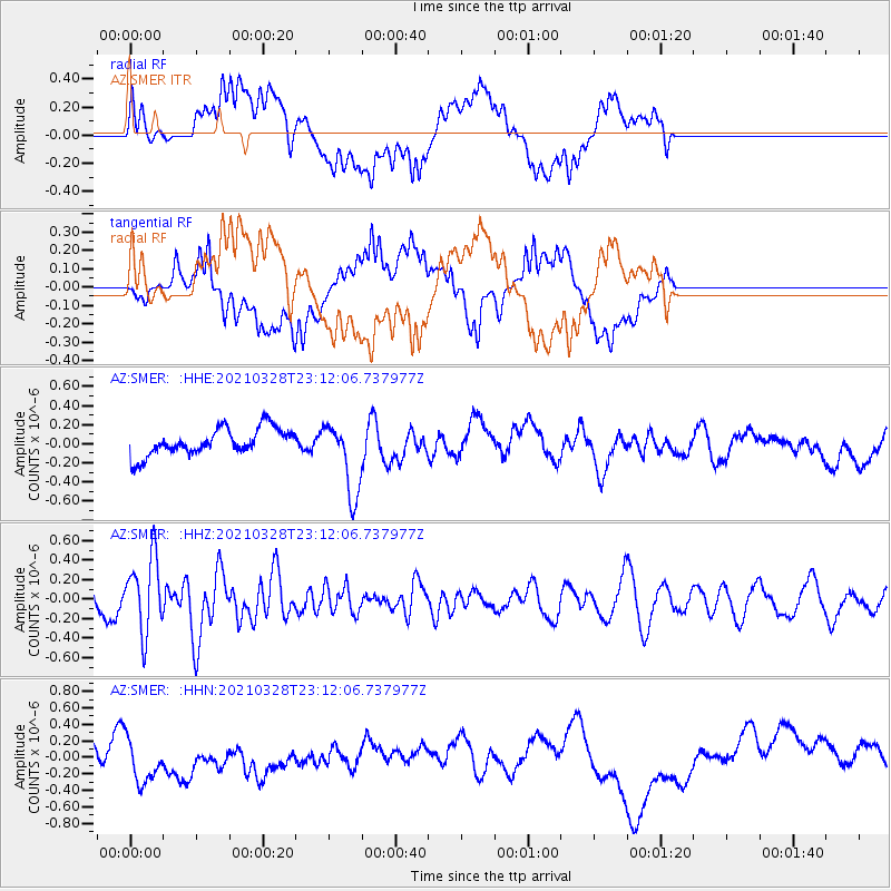
SMER AZ.SMER - Earthquake Result Viewer
*The percent match for this event was below the threshold and hence no stack was calculated.
| Earthquake location: |
Northern Mid-Atlantic Ridge |
| Earthquake latitude/longitude: |
43.6/-28.8 |
| Earthquake time(UTC): |
2021/03/28 (087) 23:01:46 GMT |
| Earthquake Depth: |
10 km |
| Earthquake Magnitude: |
5.8 Mww |
| Earthquake Catalog/Contributor: |
NEIC PDE/us |
|
| Network: |
AZ ANZA Regional Network |
| Station: |
SMER AZ.SMER |
| Lat/Lon: |
33.46 N/117.17 W |
| Elevation: |
355 m |
|
| Distance: |
66.8 deg |
| Az: |
294.577 deg |
| Baz: |
52.157 deg |
| Ray Param: |
$rayparam |
*The percent match for this event was below the threshold and hence was not used in the summary stack. |
|
| Radial Match: |
46.27199 % |
| Radial Bump: |
400 |
| Transverse Match: |
47.83275 % |
| Transverse Bump: |
400 |
| SOD ConfigId: |
24334971 |
| Insert Time: |
2021-04-11 23:08:28.290 +0000 |
| GWidth: |
2.5 |
| Max Bumps: |
400 |
| Tol: |
0.001 |
|
Signal To Noise
| Channel | StoN | STA | LTA |
| AZ:SMER: :HHZ:20210328T23:12:06.737977Z | 2.4321177 | 3.875157E-7 | 1.5933263E-7 |
| AZ:SMER: :HHN:20210328T23:12:06.737977Z | 1.1881404 | 2.93243E-7 | 2.4680838E-7 |
| AZ:SMER: :HHE:20210328T23:12:06.737977Z | 2.711594 | 3.8260922E-7 | 1.4110121E-7 |
| Arrivals |
| Ps | |
| PpPs | |
| PsPs/PpSs | |


