You are here: Home > Network List > CI - Caltech Regional Seismic Network Stations List
> Station LRL Laurel Mtn Radio Fac, Ridgecrest, CA, USA > Earthquake Result Viewer
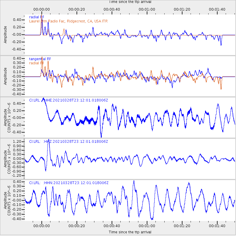
LRL Laurel Mtn Radio Fac, Ridgecrest, CA, USA - Earthquake Result Viewer
*The percent match for this event was below the threshold and hence no stack was calculated.
| Earthquake location: |
Northern Mid-Atlantic Ridge |
| Earthquake latitude/longitude: |
43.6/-28.8 |
| Earthquake time(UTC): |
2021/03/28 (087) 23:01:46 GMT |
| Earthquake Depth: |
10 km |
| Earthquake Magnitude: |
5.8 Mww |
| Earthquake Catalog/Contributor: |
NEIC PDE/us |
|
| Network: |
CI Caltech Regional Seismic Network |
| Station: |
LRL Laurel Mtn Radio Fac, Ridgecrest, CA, USA |
| Lat/Lon: |
35.48 N/117.68 W |
| Elevation: |
1340 m |
|
| Distance: |
65.9 deg |
| Az: |
296.604 deg |
| Baz: |
52.683 deg |
| Ray Param: |
$rayparam |
*The percent match for this event was below the threshold and hence was not used in the summary stack. |
|
| Radial Match: |
66.728096 % |
| Radial Bump: |
400 |
| Transverse Match: |
41.7254 % |
| Transverse Bump: |
400 |
| SOD ConfigId: |
24334971 |
| Insert Time: |
2021-04-11 23:11:34.606 +0000 |
| GWidth: |
2.5 |
| Max Bumps: |
400 |
| Tol: |
0.001 |
|
Signal To Noise
| Channel | StoN | STA | LTA |
| CI:LRL: :HHZ:20210328T23:12:01.018006Z | 5.22198 | 6.3480496E-7 | 1.2156403E-7 |
| CI:LRL: :HHN:20210328T23:12:01.018006Z | 1.5027134 | 2.1587047E-7 | 1.4365379E-7 |
| CI:LRL: :HHE:20210328T23:12:01.018006Z | 1.3908961 | 2.601118E-7 | 1.8701024E-7 |
| Arrivals |
| Ps | |
| PpPs | |
| PsPs/PpSs | |


