You are here: Home > Network List > CI - Caltech Regional Seismic Network Stations List
> Station MPM Manuel Prospect Mine, California, USA > Earthquake Result Viewer
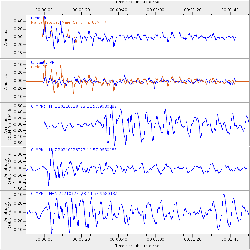
MPM Manuel Prospect Mine, California, USA - Earthquake Result Viewer
*The percent match for this event was below the threshold and hence no stack was calculated.
| Earthquake location: |
Northern Mid-Atlantic Ridge |
| Earthquake latitude/longitude: |
43.6/-28.8 |
| Earthquake time(UTC): |
2021/03/28 (087) 23:01:46 GMT |
| Earthquake Depth: |
10 km |
| Earthquake Magnitude: |
5.8 Mww |
| Earthquake Catalog/Contributor: |
NEIC PDE/us |
|
| Network: |
CI Caltech Regional Seismic Network |
| Station: |
MPM Manuel Prospect Mine, California, USA |
| Lat/Lon: |
36.06 N/117.49 W |
| Elevation: |
185 m |
|
| Distance: |
65.4 deg |
| Az: |
297.005 deg |
| Baz: |
52.96 deg |
| Ray Param: |
$rayparam |
*The percent match for this event was below the threshold and hence was not used in the summary stack. |
|
| Radial Match: |
78.77302 % |
| Radial Bump: |
368 |
| Transverse Match: |
66.261116 % |
| Transverse Bump: |
400 |
| SOD ConfigId: |
24334971 |
| Insert Time: |
2021-04-11 23:11:38.752 +0000 |
| GWidth: |
2.5 |
| Max Bumps: |
400 |
| Tol: |
0.001 |
|
Signal To Noise
| Channel | StoN | STA | LTA |
| CI:MPM: :HHZ:20210328T23:11:57.968018Z | 6.176141 | 7.2891646E-7 | 1.18021354E-7 |
| CI:MPM: :HHN:20210328T23:11:57.968018Z | 2.6061685 | 2.1417176E-7 | 8.2178786E-8 |
| CI:MPM: :HHE:20210328T23:11:57.968018Z | 4.753756 | 2.6863842E-7 | 5.651077E-8 |
| Arrivals |
| Ps | |
| PpPs | |
| PsPs/PpSs | |


