You are here: Home > Network List > IU - Global Seismograph Network (GSN - IRIS/USGS) Stations List
> Station POHA Pohakuloa, Hawaii, USA > Earthquake Result Viewer
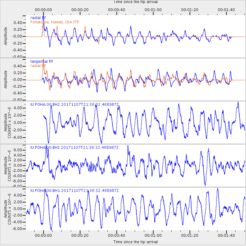
POHA Pohakuloa, Hawaii, USA - Earthquake Result Viewer
*The percent match for this event was below the threshold and hence no stack was calculated.
| Earthquake location: |
New Guinea, Papua New Guinea |
| Earthquake latitude/longitude: |
-4.2/143.5 |
| Earthquake time(UTC): |
2017/11/07 (311) 21:26:38 GMT |
| Earthquake Depth: |
107 km |
| Earthquake Magnitude: |
6.5 mww |
| Earthquake Catalog/Contributor: |
NEIC PDE/us |
|
| Network: |
IU Global Seismograph Network (GSN - IRIS/USGS) |
| Station: |
POHA Pohakuloa, Hawaii, USA |
| Lat/Lon: |
19.76 N/155.53 W |
| Elevation: |
1990 m |
|
| Distance: |
64.5 deg |
| Az: |
65.892 deg |
| Baz: |
255.135 deg |
| Ray Param: |
$rayparam |
*The percent match for this event was below the threshold and hence was not used in the summary stack. |
|
| Radial Match: |
62.129524 % |
| Radial Bump: |
400 |
| Transverse Match: |
47.59223 % |
| Transverse Bump: |
400 |
| SOD ConfigId: |
2429771 |
| Insert Time: |
2017-11-21 21:28:09.380 +0000 |
| GWidth: |
2.5 |
| Max Bumps: |
400 |
| Tol: |
0.001 |
|
Signal To Noise
| Channel | StoN | STA | LTA |
| IU:POHA:00:BHZ:20171107T21:36:32.468987Z | 1.933526 | 3.4954676E-6 | 1.8078204E-6 |
| IU:POHA:00:BH1:20171107T21:36:32.468987Z | 2.438464 | 4.223107E-6 | 1.7318719E-6 |
| IU:POHA:00:BH2:20171107T21:36:32.468987Z | 1.484789 | 2.929376E-6 | 1.9729239E-6 |
| Arrivals |
| Ps | |
| PpPs | |
| PsPs/PpSs | |


